MyTopo
Harris Tennessee US Topo Map
Couldn't load pickup availability
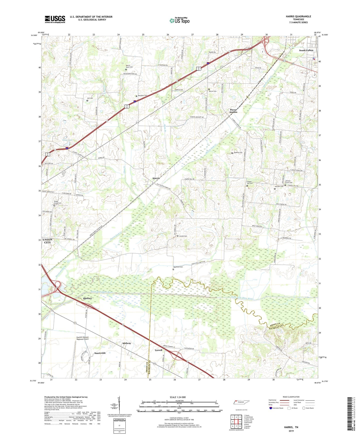
2022 topographic map quadrangle Harris in the state of Tennessee. Scale: 1:24000. Based on the newly updated USGS 7.5' US Topo map series, this map is in the following counties: Obion, Weakley. The map contains contour data, water features, and other items you are used to seeing on USGS maps, but also has updated roads and other features. This is the next generation of topographic maps. Printed on high-quality waterproof paper with UV fade-resistant inks.
Quads adjacent to this one:
West: Union City
Northwest: Cayce
North: Crutchfield
Northeast: Water Valley
East: McConnell
Southeast: Martin
South: Gardner
Southwest: Rives
This map covers the same area as the classic USGS quad with code o36088d8.
Contains the following named places: Arnold Cemetery, Chambers, Chapel Hill Cemetery, Chapel Hill Church, City of South Fulton, City of South Fulton Wastewater Treatment Plant, Commissioner District 1, Deer Creek, Everett-Stewart Regional Airport, Gill Cemetery, Harris, Hicks Branch, Johnson Cemetery, Johnson Grove Cemetery, Johnsons Grove Church, Little Cypress Creek, Midway, Morris Slave Cemetery, Murphey Cemetery, Pierce Cemetery, Pierce Station, Rankins Cemetery, Richland Creek, Shady Grove Cemetery, Shady Grove Church, Shofner, South Fulton Division, South Fulton Fire Department, South Fulton High School, South Fulton Industrial Park, South Fulton Police Department, South Fulton Shopping Plaza, Sunnyside, Terrell, Terrell Post Office, Valentine Cemetery, WALR-FM (Union City), White Dam, White Lake, ZIP Code: 38257