MyTopo
Oakton Kentucky US Topo Map
Couldn't load pickup availability
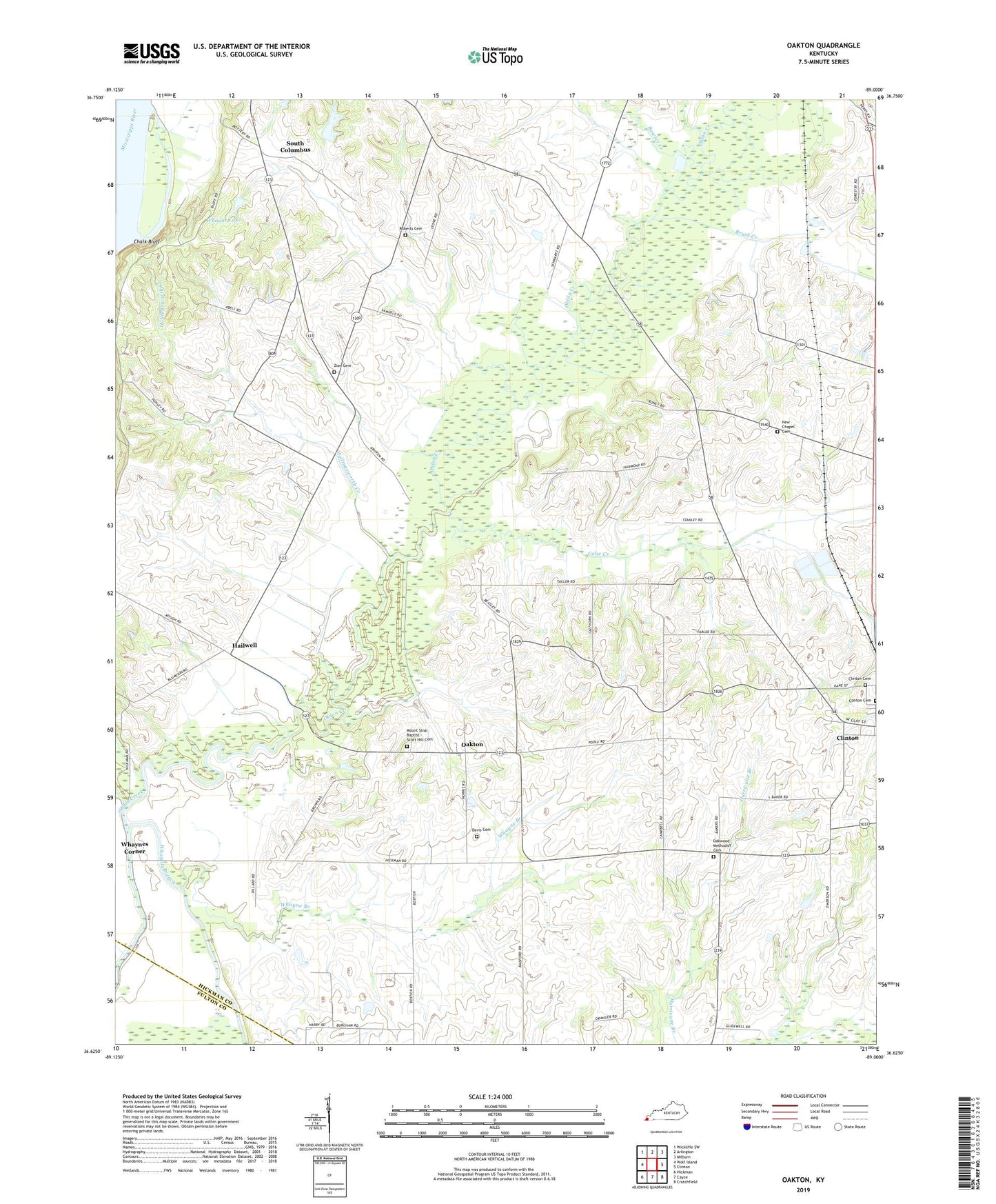
2022 topographic map quadrangle Oakton in the state of Kentucky. Scale: 1:24000. Based on the newly updated USGS 7.5' US Topo map series, this map is in the following counties: Hickman, Fulton. The map contains contour data, water features, and other items you are used to seeing on USGS maps, but also has updated roads and other features. This is the next generation of topographic maps. Printed on high-quality waterproof paper with UV fade-resistant inks.
Quads adjacent to this one:
West: Wolf Island
Northwest: Wickliffe SW
North: Arlington
Northeast: Milburn
East: Clinton
Southeast: Crutchfield
South: Cayce
Southwest: Hickman
This map covers the same area as the classic USGS quad with code o36089f1.
Contains the following named places: Bluff, Bowles Creek, Brush Creek, Cane Creek, Clinton Cemetery, Columbus Division, Davis Cemetery, Dry Lake, Hailwell, Hollingsworth Creek, Midway, Moss, Mount Sinai Baptist - Scott Hill Cemetery, New Chapel, New Chapel Cemetery, New Harmony Baptist Church, Oakton, Oakwood Church, Oakwood Methodist Cemetery, Obion Church, Roberts Cemetery, Scott, South Columbus, Tar Heel, Whayne Branch, Whayne Lake, Whaynes Corner, Zion, Zion Cemetery, Zion Church