MyTopo
Dunnville Kentucky US Topo Map
Couldn't load pickup availability
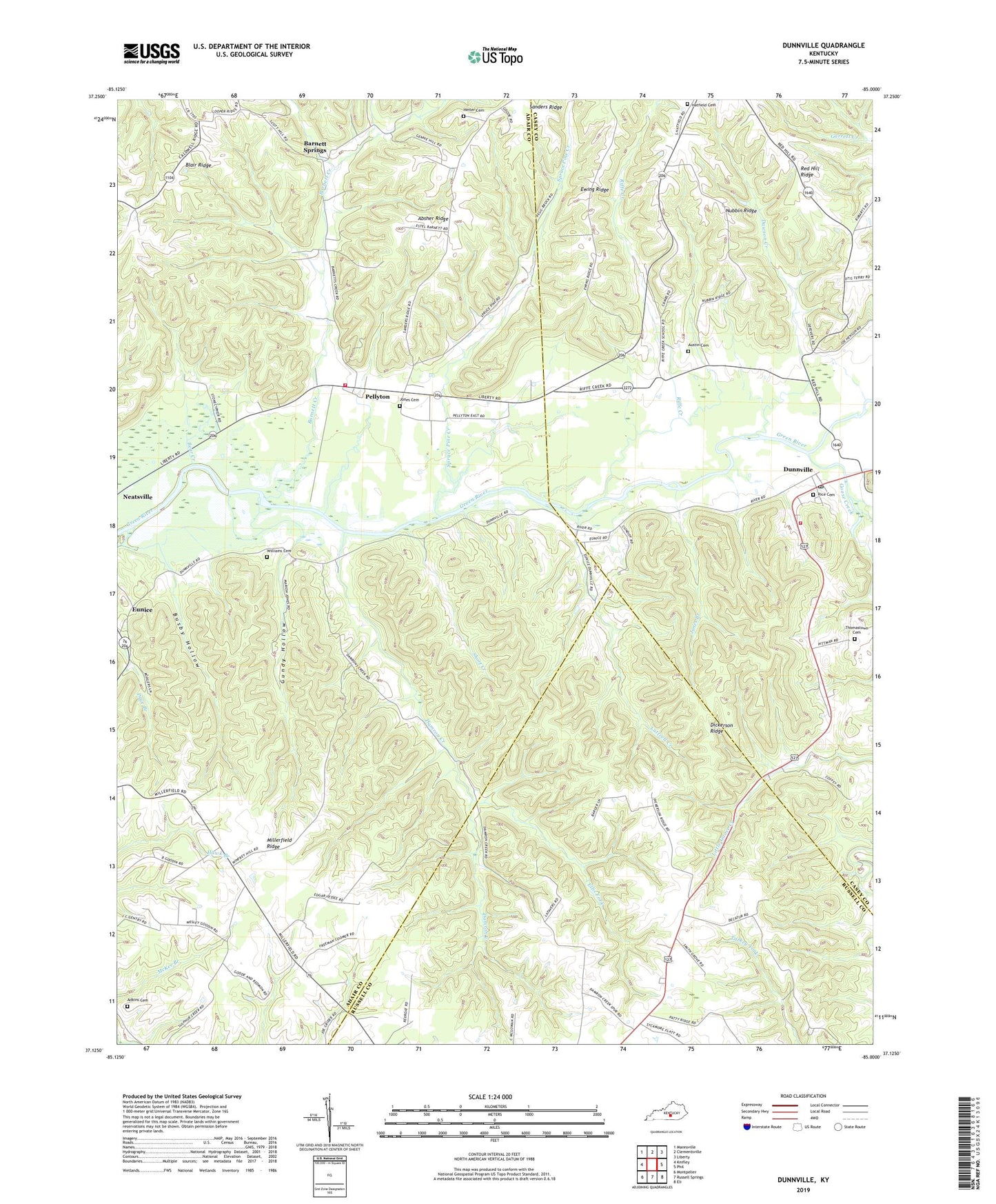
2022 topographic map quadrangle Dunnville in the state of Kentucky. Scale: 1:24000. Based on the newly updated USGS 7.5' US Topo map series, this map is in the following counties: Adair, Casey, Russell. The map contains contour data, water features, and other items you are used to seeing on USGS maps, but also has updated roads and other features. This is the next generation of topographic maps. Printed on high-quality waterproof paper with UV fade-resistant inks.
Quads adjacent to this one:
West: Knifley
Northwest: Mannsville
North: Clementsville
Northeast: Liberty
East: Phil
Southeast: Eli
South: Russell Springs
Southwest: Montpelier
This map covers the same area as the classic USGS quad with code o37085b1.
Contains the following named places: Absher Ridge, Adkins Cemetery, Austin Cemetery, Barnett Creek, Barnett Creek Church, Barnett Springs, Bear Creek, Busby Hollow, Damron Creek, Dawson Creek, Dickerson Ridge, Dunnville, Dunnville Post Office, Dunnville School, Dunnville Volunteer Fire Department, Ellis Fork, Eunice, Ewing Ridge, Good Tidings Church, Goose Creek, Gundy Hollow, Hatfield Cemetery, Heiter Cemetery, Jones Branch, Jones Cemetery, Luttrell Creek, Millerfield, Millerfield Church, Millerfield Ridge, Mount Calvary Church, Normans Chapel United Brethren Church, Nubbin Ridge, Pellyton, Pellyton Volunteer Fire Department, Red Hill, Red Hill Ridge, Red Hill School, Rice Cemetery, Rife Creek Post Office, Riffe Creek, Riffe Creek School, Rifle Creek Church, Sanders Ridge, Shady Grove Church, Short Creek, Spruce Pine Creek, Thomastown Cemetery, Williams Cemetery, Wilson School, ZIP Code: 42528