MyTopo
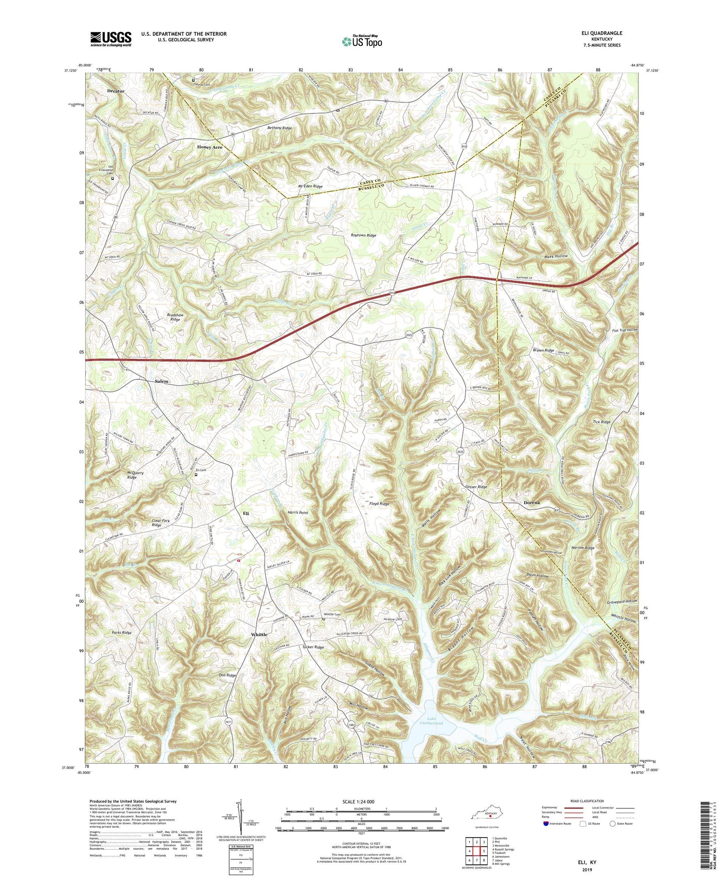
Eli Kentucky US Topo Map
Couldn't load pickup availability
2022 topographic map quadrangle Eli in the state of Kentucky. Scale: 1:24000. Based on the newly updated USGS 7.5' US Topo map series, this map is in the following counties: Russell, Pulaski, Casey. The map contains contour data, water features, and other items you are used to seeing on USGS maps, but also has updated roads and other features. This is the next generation of topographic maps. Printed on high-quality waterproof paper with UV fade-resistant inks.
Quads adjacent to this one:
West: Russell Springs
Northwest: Dunnville
North: Phil
Northeast: Mintonville
East: Faubush
Southeast: Mill Springs
South: Jabez
Southwest: Jamestown
This map covers the same area as the classic USGS quad with code o37084a8.
Contains the following named places: Ace Hollow, Alligator Creek, Bethany Church of Christ, Bethany Ridge, Bethany School, Black Hollow, Bradshaw Ridge, Brown Ridge, Bryant Hollow, Cedar Springs Church, Clear Fork Church, Clear Fork Ridge, Cooper Creek, Davis Hollow, Dickenson Hollow, Dorena, Dry Branch, East Fork Alligator Creek, Eli, Eli Cemetery, Eli Division, Eli Volunteer Fire Department, Fish Trap Hollow, Floyd Ridge, Freedom Branch, Friendship Baptist Church, Gable Hollow, Gosser Ridge, Graveyard Hollow, Harris Point, Honey Acre, Horse Branch, House Fork Creek, Irvin Branch, Irvins Store, Little Creek, Little Goose Creek, Little Weddle Creek, Locust Grove Church, McQuarry Ridge, Meek Hollow, Mill Hollow, Mount Eden Church, Mount Eden Ridge, Mud Lick, Narrow Ridge, Neat Hollow, New Pleasant Point Church, Old Friendship Cemetery, Ono Ridge, Parks Ridge, Parks Ridge Church of God, Pine Grove Church, Pinetop Church, Possum Hollow, Puncheon Camp Creek, Roaring Branch, Rock Lick Hollow, Rouse Branch, Roy Branch, Roytown Ridge, Salem, Salem Branch, Starling Branch, State Branch, Thomas Cemetery, Tucker Ridge, Turkey Fork, Union Church, Wells Hollow, West Fork Alligator Creek, Whittle, Whittle Cemetery, Whittle Hollow, Windsor Post Office


