MyTopo
Mannsville Kentucky US Topo Map
Couldn't load pickup availability
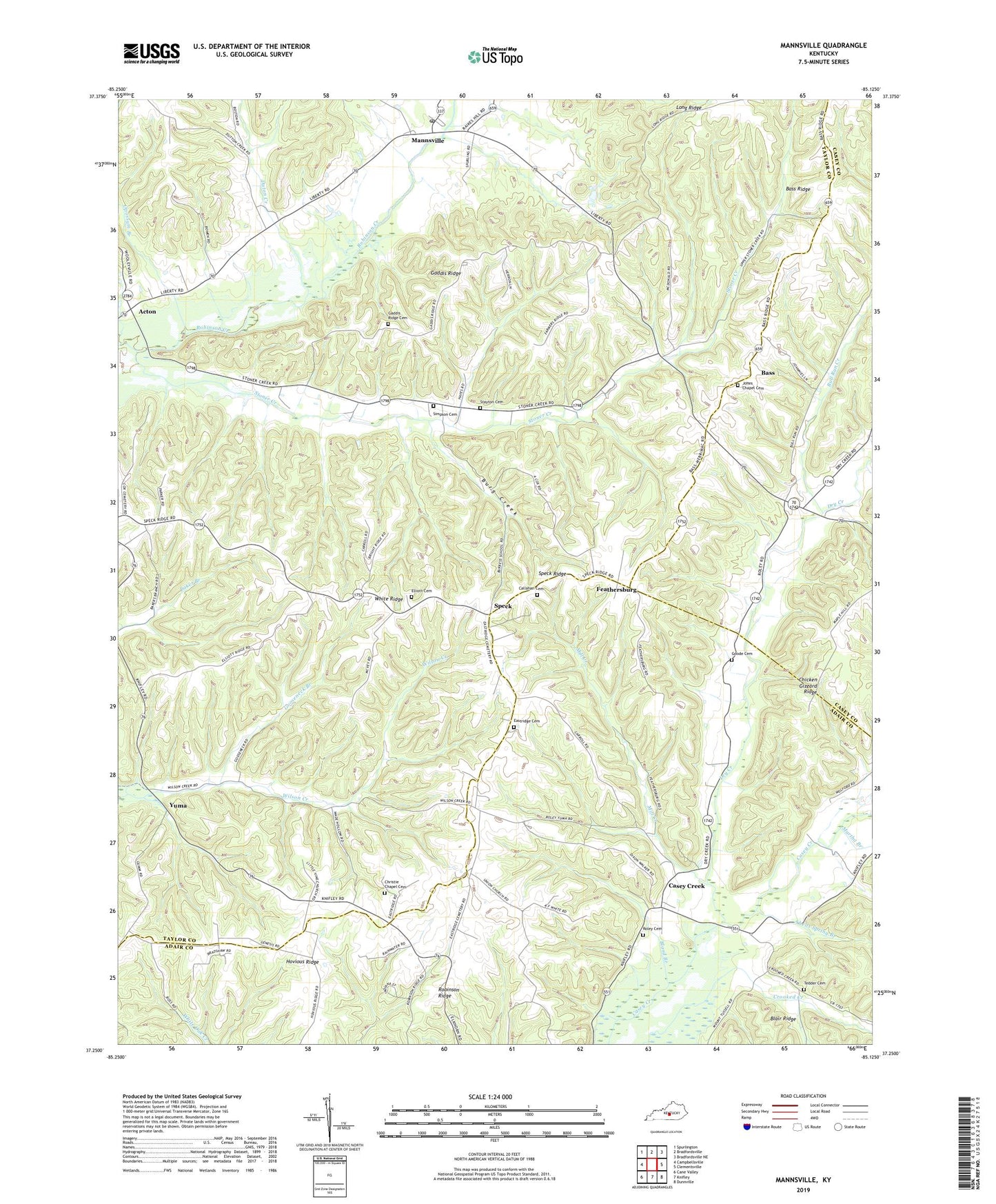
2022 topographic map quadrangle Mannsville in the state of Kentucky. Scale: 1:24000. Based on the newly updated USGS 7.5' US Topo map series, this map is in the following counties: Taylor, Adair, Casey. The map contains contour data, water features, and other items you are used to seeing on USGS maps, but also has updated roads and other features. This is the next generation of topographic maps. Printed on high-quality waterproof paper with UV fade-resistant inks.
Quads adjacent to this one:
West: Campbellsville
Northwest: Spurlington
North: Bradfordsville
Northeast: Bradfordsville NE
East: Clementsville
Southeast: Dunnville
South: Knifley
Southwest: Cane Valley
This map covers the same area as the classic USGS quad with code o37085c2.
Contains the following named places: Abells Spring Branch, Acton, Bass, Bass Ridge, Beech Grove School, Bland Branch, Bull Run Creek, Burg Creek, Callahan Cemetery, Camp Acton, Casey Creek, Christie Chapel, Christie Chapel Cemetery, Dry Creek, Duton Creek, Eastridge Cemetery, Elliott Cemetery, Farmers Chapel, Feathersburg, Gaddis Ridge, Gaddis Ridge Cemetery, Goode Cemetery, Gooseneck Branch, Hovious Ridge, Jones Chapel, Jones Chapel Cemetery, Knifley Church, Little Vine Church, Long Ridge, Lucinda Post Office, Mannsville, Mannsville Post Office, Martha Branch, Mill Creek, Mount Zion Church, Opossum Branch, Roley Cemetery, Roley Christian Church, Simpson Cemetery, Speck, Speck Ridge, Stayton Cemetery, Stoner Creek Church, Tedder Cemetery, Union Church, White Ridge, White Ridge Church, Yuma, Yuma Church, ZIP Codes: 42733, 42758