MyTopo
Hedges Kentucky US Topo Map
Couldn't load pickup availability
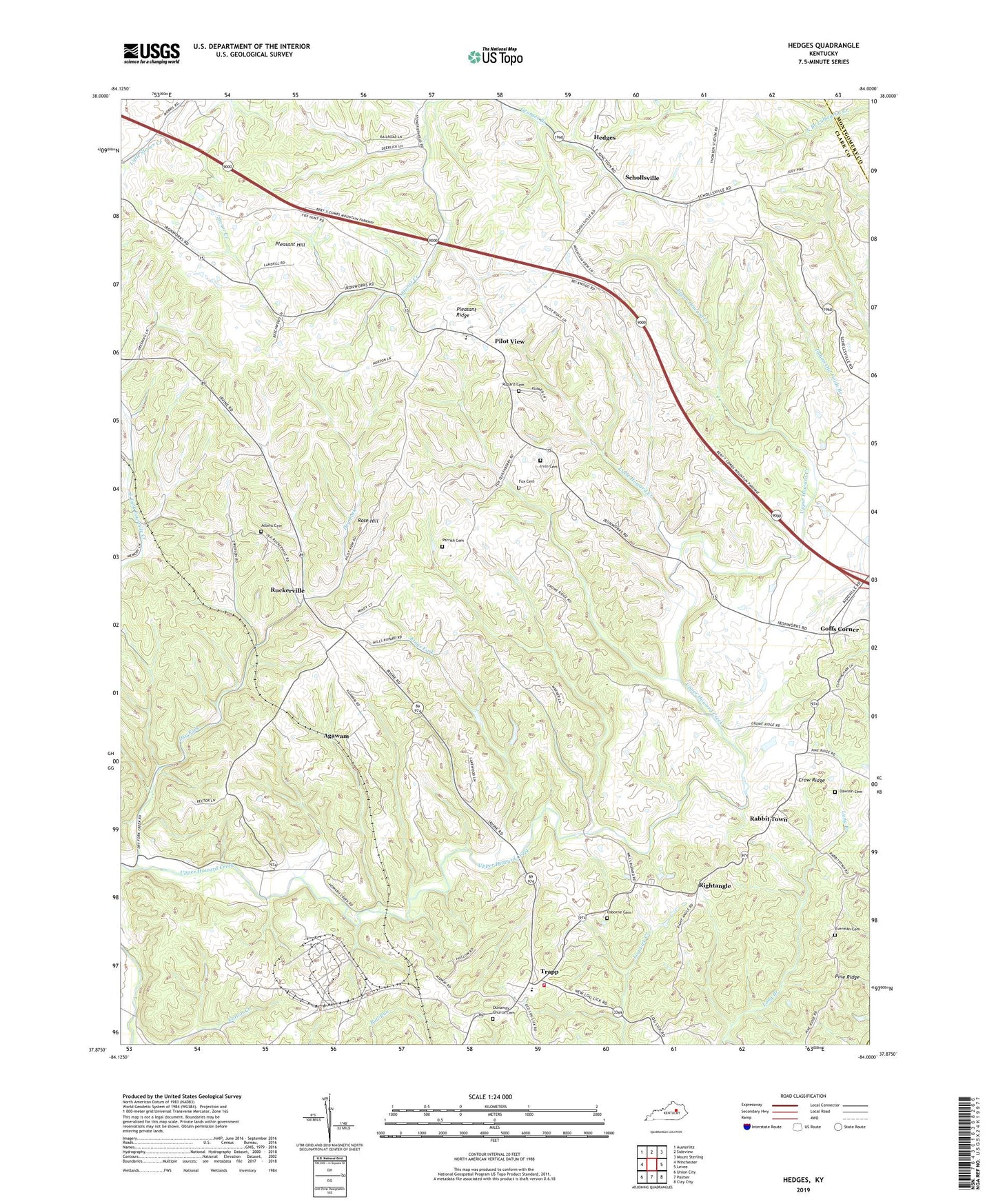
2022 topographic map quadrangle Hedges in the state of Kentucky. Scale: 1:24000. Based on the newly updated USGS 7.5' US Topo map series, this map is in the following counties: Clark, Montgomery, Powell. The map contains contour data, water features, and other items you are used to seeing on USGS maps, but also has updated roads and other features. This is the next generation of topographic maps. Printed on high-quality waterproof paper with UV fade-resistant inks.
Quads adjacent to this one:
West: Winchester
Northwest: Austerlitz
North: Sideview
Northeast: Mount Sterling
East: Levee
Southeast: Clay City
South: Palmer
Southwest: Union City
This map covers the same area as the classic USGS quad with code o37084h1.
Contains the following named places: Adams Cemetery, Agawam, Agawam Flag Stop, Arlen Post Office, Bethlehem Baptist Church, Bloomingdale Post Office, Boones Creek Church Camp, Chilton Post Office, Clark County Trapp Fire Department, Corinth Baptist Church, Crow Ridge, Dawson Cemetery, Dry Fork, Dunaway Church Cemetery, Dunaway Methodist Church, Dunaway Post Office, Edgewood, El Bethel Church, Ephesus Baptist Church, Everman Cemetery, Fox Cemetery, Fox Railroad Station, Fruitland, Goffs Corner, Hedges, Hedges Post Office, Hedges Railroad Station, Irvin Cemetery, Kings Fork, Little Dry Fork, Little Howard Creek, Midway, Midway Church, Moundale, Osborne Cemetery, Parrish Cemetery, Pharris Hill Christian Church, Pharris Store, Pilot View, Pilot View Post Office, Pilot View School, Pine Ridge, Pleasant Hill, Pleasant Ridge, Rabbit Town, Raker Railroad Station, Rightangle, Rightangle Post Office, Rose Hill, Ruckerville, Ruckerville Christian Church, Ruckerville Post Office, Rupard Cemetery, Schollsville, Snowden, Southeast Clark Division, Trapp, Trapp Elementary School, Trapp Post Office