MyTopo
Levee Kentucky US Topo Map
Couldn't load pickup availability
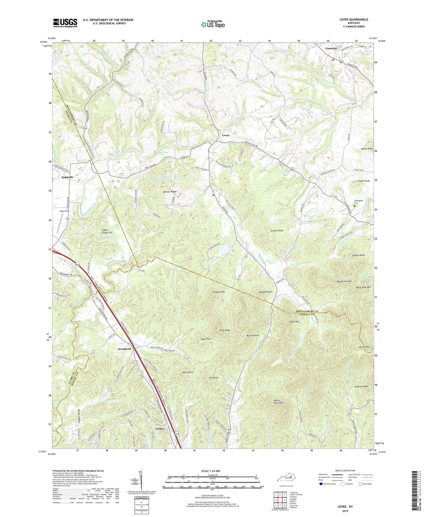
2022 topographic map quadrangle Levee in the state of Kentucky. Scale: 1:24000. Based on the newly updated USGS 7.5' US Topo map series, this map is in the following counties: Montgomery, Powell, Clark. The map contains contour data, water features, and other items you are used to seeing on USGS maps, but also has updated roads and other features. This is the next generation of topographic maps. Printed on high-quality waterproof paper with UV fade-resistant inks.
Quads adjacent to this one:
West: Hedges
Northwest: Sideview
North: Mount Sterling
Northeast: Preston
East: Means
Southeast: Stanton
South: Clay City
Southwest: Palmer
This map covers the same area as the classic USGS quad with code o37083h8.
Contains the following named places: Argyle Railroad Station, Ashgrove, Barlow Ridge, Black Creek, Black Creek United Church, Bowles Branch, Bowling Fork, Brushy Lick Fork, Camargo, Camargo Post Office, Camp McKee Boy Scout Reservation, Camp Richard Clark, City of Camargo, Combs Branch, Cooperas Creek, Cream Alley Branch, Crooked Ash Branch, Douglas Point, Dry Branch, Faith Pentecostal Church, Falls Branch, Ficklin Knob, Grape Knob, Gravel Knob, Hardwicks Branch, Hidden Valley, Hisle Field, Hog Creek, Hollywood Springs, Indian Fields, Indian Fields Hill, Indian Fields Post Office, Indian Fields Railroad Station, Indian Old Fields, Indian Old Fields Branch, Kiddville, Kiddville Post Office, Kit Point, Levee, Levee Post Office, Levee School, Macedonia Church, Mary Jane Mountain, McKenzies Chapel, Montgomery County Fire District Station 3, Montgomery County Fire District Station 4 Levee, Morris Mountain, Mount Gilead Cumberland Presbyterian Church, Mount Sterling Church, New Providence, New Providence Baptist Church, North Branch Lulbegrud Creek, Oil Springs, Oil Springs Branch, Oldham Pond, Paint Creek, Pilot Knob, Pine Grove Church, Piolet Knob Historical Marker, Potato Knob, Right Fork Hog Creek, Rotten Point, Sage Point, Spencer Morton Preserve, Still House Branch, Thomas Mill, Toler Mountain, Trimble, Virden, Virden Post Office, Virden Railroad Station, Ware Point, Welch Knob, Westbend, Westbend Church, Westbend Post Office, Westbrook Mountain, White Rock Mountain, White Rock Quarry, Wildcat Knob, Willoughby Cemetery