MyTopo
Sideview Kentucky US Topo Map
Couldn't load pickup availability
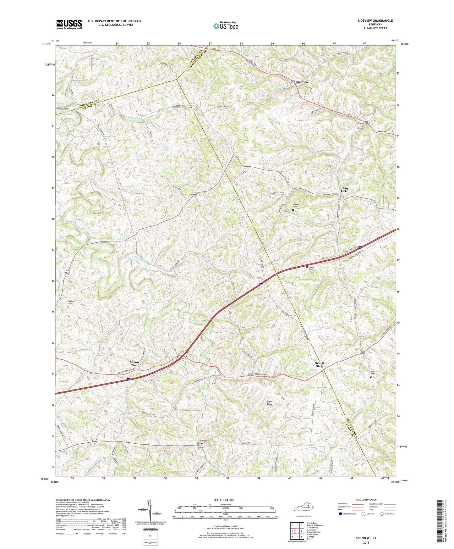
2022 topographic map quadrangle Sideview in the state of Kentucky. Scale: 1:24000. Based on the newly updated USGS 7.5' US Topo map series, this map is in the following counties: Clark, Montgomery, Bourbon. The map contains contour data, water features, and other items you are used to seeing on USGS maps, but also has updated roads and other features. This is the next generation of topographic maps. Printed on high-quality waterproof paper with UV fade-resistant inks.
Quads adjacent to this one:
West: Austerlitz
Northwest: Paris East
North: North Middletown
Northeast: Sharpsburg
East: Mount Sterling
Southeast: Levee
South: Hedges
Southwest: Winchester
This map covers the same area as the classic USGS quad with code o38084a1.
Contains the following named places: Botts Post Office, Cabin Creek, Cave Hill, Centerville, Centerville School, Cornwell Stock Farm, Deephole School, Dodge Post Office, Donaldson Church, Donaldson Creek, Ecton Pike Bridge, Fort Barker, French Cemetery, Fryville Post Office, Georges Branch, Goose Creek, Goshen Baptist Church, Grassy Lick, Grassy Lick Bridge, Grassy Lick Methodist Church, Greene Cemetery, Haineys Mill, Halfway House, Hayden Cemetery, Highland Cottage Stock Farm, L and E Junction, Little Stoner Creek, Mistletoe Railroad Station, Mount Carmel Baptist Church, Mount Ida Church, Mount Ida Post Office, Mount Zion, Mount Zion Methodist Church, Pleasant Hill Stock Farm, Pleasant Ridge, Prewitt Cemetery, Sewell Shop, Sideview, Sideview Post Office, Skinners Mill, Stoner Farm, Stoner Post Office, Sugar Ridge, Sunnyside Stock Farm, Thomson, Thomson Post Office, Thomson Railroad Station, Union Church, Wades Mill, Wades Mill Post Office, Watauga Railroad Station, William Wades Store