MyTopo
Henderson Kentucky US Topo Map
Couldn't load pickup availability
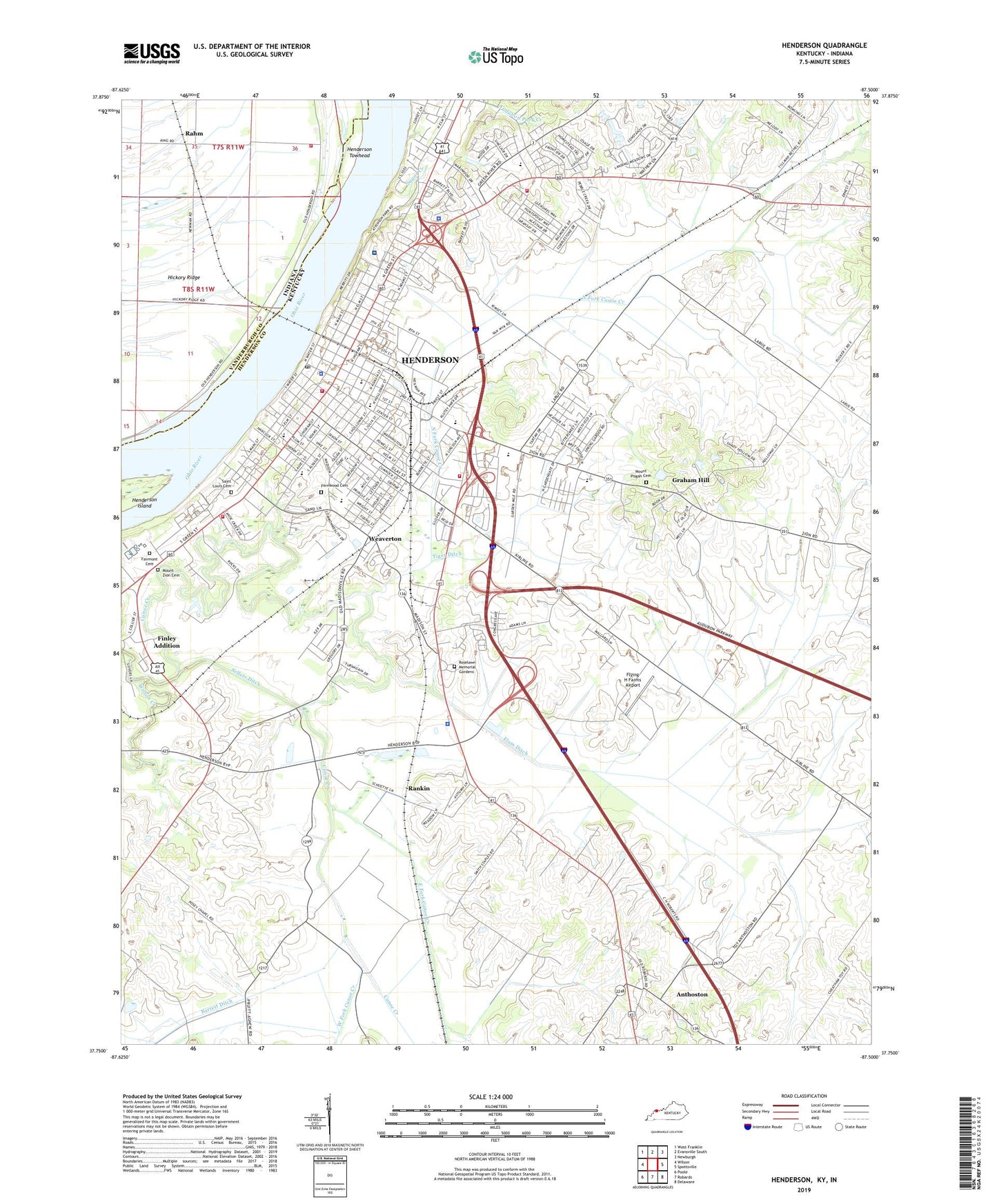
2022 topographic map quadrangle Henderson in the states of Kentucky, Indiana. Scale: 1:24000. Based on the newly updated USGS 7.5' US Topo map series, this map is in the following counties: Henderson, Vanderburgh. The map contains contour data, water features, and other items you are used to seeing on USGS maps, but also has updated roads and other features. This is the next generation of topographic maps. Printed on high-quality waterproof paper with UV fade-resistant inks.
Quads adjacent to this one:
West: Wilson
Northwest: West Franklin
North: Evansville South
Northeast: Newburgh
East: Spottsville
Southeast: Delaware
South: Robards
Southwest: Poole
This map covers the same area as the classic USGS quad with code o37087g5.
Contains the following named places: A R Johnsons Raid Historical Marker, Albert B Happy Chandler Historical Marker, Anthoston, Anthoston Census Designated Place, Atkinson Park, Audubon Mill Park, Audubon Saw and Grist Mill Historical Marker, Audubon School, Augustus Owsley Stanley Historical Marker, Barrett Stadium, Bellfield Baptist Church, Bend Gate Elementary School, Chapel Hill Church, City of Henderson, East Fork Canoe Creek, East Heights Elementary School, Elam Ditch, Fairmont Cemetery, Fernwood Cemetery, Fernwood Cemetery Historical Marker, Finley Addition, Flying H Farms Airport, General Samuel Hopkins Historical Marker, Graham Hill, Henderson, Henderson Ambulance Service, Henderson County, Henderson County Historical Marker, Henderson County Sheriff's Office, Henderson Division, Henderson Fire Department Station 1, Henderson Fire Department Station 2, Henderson Fire Department Station 3, Henderson Fire Department Station 4, Henderson Police Department, Henderson Post Office, Henderson Towhead, Holy Name School, Home of Lucy Furman Historical Marker, Jefferson School, Kentucky State Police Post 16, Kimmel Homestead Historical Marker, Lewis and Clark in Henderson Historical Marker, Methodist Hospital, Mothers Day Historical Marker, Mount Pisgah Cemetery, Mount Zion Cemetery, North Fork Canoe Creek, Perry Township Volunteer Fire Department Station 3, Rahm, Rankin, Roselawn Memorial Gardens, Saint Louis Cemetery, Saint Pauls Episcopal Church Historical Marker, Sanderfur Training School, Sellers Ditch, Seventh Street School, South Heights School, Sugar Creek, Sunset Park, Tiger Ditch, Transylvania Company Historical Marker, Walnut Hill Church, Weaverton, Weaverton School, WEHT-TV (Evansville), West Fork Canoe Creek, WGBF-FM (Henderson), Wilson Creek, WSON-AM (Henderson), ZIP Code: 42420