MyTopo
Delaware Kentucky US Topo Map
Couldn't load pickup availability
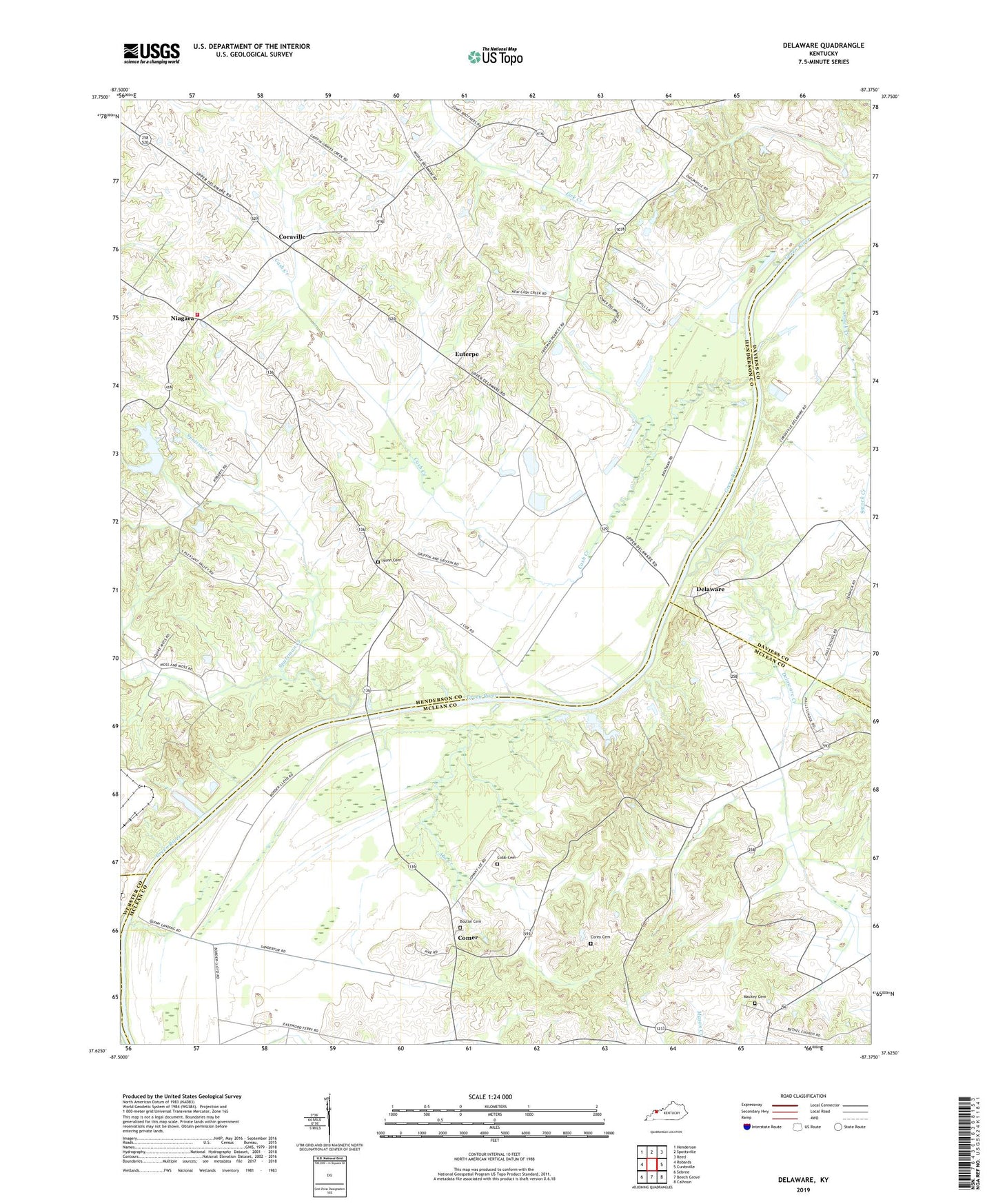
2022 topographic map quadrangle Delaware in the state of Kentucky. Scale: 1:24000. Based on the newly updated USGS 7.5' US Topo map series, this map is in the following counties: Henderson, McLean, Daviess, Webster. The map contains contour data, water features, and other items you are used to seeing on USGS maps, but also has updated roads and other features. This is the next generation of topographic maps. Printed on high-quality waterproof paper with UV fade-resistant inks.
Quads adjacent to this one:
West: Robards
Northwest: Henderson
North: Spottsville
Northeast: Reed
East: Curdsville
Southeast: Calhoun
South: Beech Grove
Southwest: Sebree
This map covers the same area as the classic USGS quad with code o37087f4.
Contains the following named places: Abe Creek, Bethel Church, Boston Cemetery, Cash Creek, Cash Creek Church, Cobb Cemetery, Comer, Coraville, Corey Cemetery, Delaware, Delaware Creek, Delaware Creek Church, Euterpe, Hebbardsville-Robards Division, James Bethel Gresham Historical Marker, Mackey Cemetery, Niagara, Niagara Fire Department, Nunn Cemetery, Pleasant Valley Church, Quinn Landing, Rangers Landing, Sputzman Creek