MyTopo
Honey Grove Kentucky US Topo Map
Couldn't load pickup availability
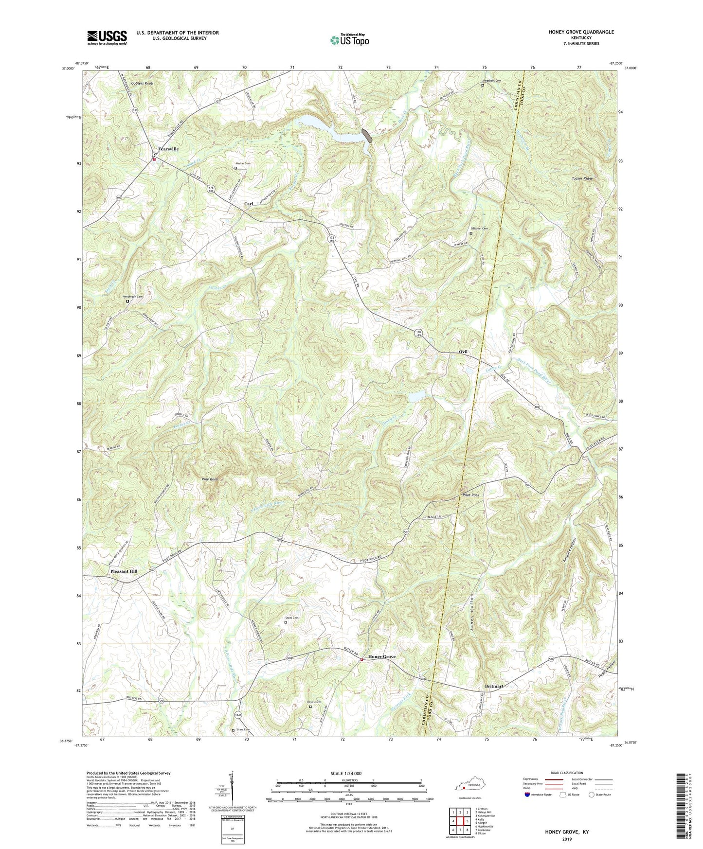
2022 topographic map quadrangle Honey Grove in the state of Kentucky. Scale: 1:24000. Based on the newly updated USGS 7.5' US Topo map series, this map is in the following counties: Christian, Todd. The map contains contour data, water features, and other items you are used to seeing on USGS maps, but also has updated roads and other features. This is the next generation of topographic maps. Printed on high-quality waterproof paper with UV fade-resistant inks.
Quads adjacent to this one:
West: Kelly
Northwest: Crofton
North: Haleys Mill
Northeast: Kirkmansville
East: Allegre
Southeast: Elkton
South: Pembroke
Southwest: Hopkinsville
This map covers the same area as the classic USGS quad with code o36087h3.
Contains the following named places: Britmart, Buck Creek, Buck Creek Lake, Caney Creek, Carl, Ebenezer Church, Fearsville, Flat Rock, Flat Rock School, Forbes Creek, Goblers Knob, Hayes Cemetery, Henderson Cemetery, Honey Grove, Honey Grove Volunteer Fire Department, Jones Hollow, Lacy Elementary School, Lacy Volunteer Fire Department, Laytonsville, Laytonsville School, Martin Cemetery, O'Daniel Cemetery, Ovil, Perry, Perry School, Pilot Rock, Pine Knob, Pleasant Hill, Pleasant Hill Baptist Church, Shaw Cemetery, Shiloh School, Steel Cemetery, Tucker Ridge, Tuckertown, Turnpike Hollow, Vaughn Grove Church, Weathers Cemetery, West Union, West Union Church