MyTopo
Elkton Kentucky US Topo Map
Couldn't load pickup availability
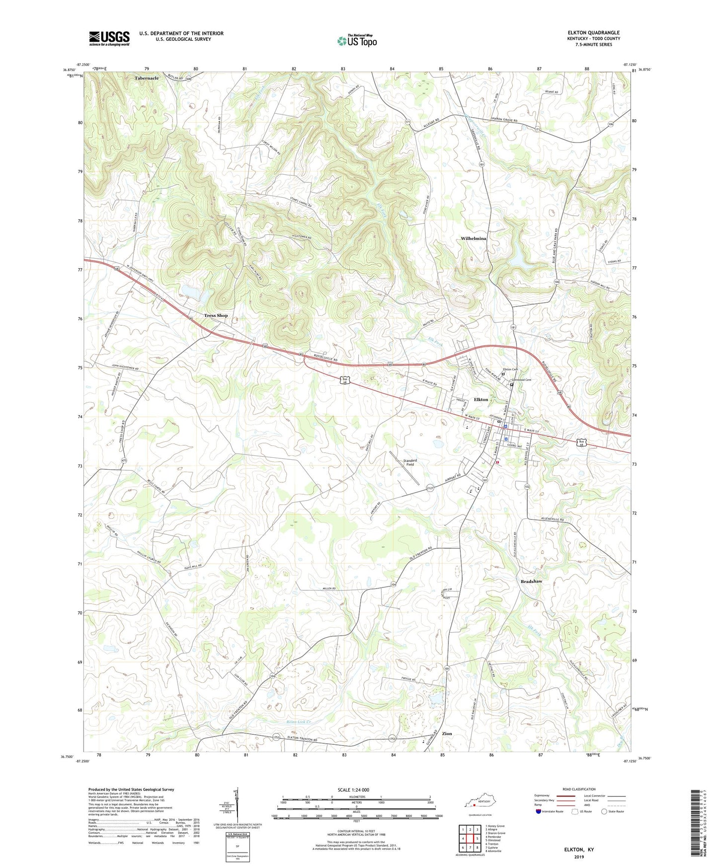
2022 topographic map quadrangle Elkton in the state of Kentucky. Scale: 1:24000. Based on the newly updated USGS 7.5' US Topo map series, this map is in the following counties: Todd. The map contains contour data, water features, and other items you are used to seeing on USGS maps, but also has updated roads and other features. This is the next generation of topographic maps. Printed on high-quality waterproof paper with UV fade-resistant inks.
Quads adjacent to this one:
West: Pembroke
Northwest: Honey Grove
North: Allegre
Northeast: Sharon Grove
East: Olmstead
Southeast: Allensville
South: Guthrie
Southwest: Trenton
This map covers the same area as the classic USGS quad with code o36087g2.
Contains the following named places: Benjamin Helm Bristow Historical Marker, Bethel Church, Bradshaw, City of Elkton, Elkton, Elkton Cemetery, Elkton Division, Elkton Fire Department, Elkton Police Department, Elkton Post Office, Emmanuel Church, Glenwood Cemetery, James Clark McReynolds Historical Marker, Little Union School, Philippi Church, Standard Field, Stokes Chapel, Tabernacle, Taylors Chapel, Taylors Chapel School, Todd County, Todd County Ambulance Service, Todd County Historical Marker, Todd County Sheriff's Office, Tress Shop, WEKT-AM (Elkton), Wilhelmina, Zion