MyTopo
Pembroke Kentucky US Topo Map
Couldn't load pickup availability
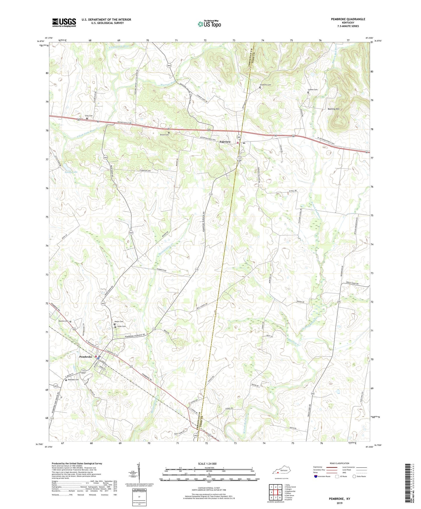
2022 topographic map quadrangle Pembroke in the state of Kentucky. Scale: 1:24000. Based on the newly updated USGS 7.5' US Topo map series, this map is in the following counties: Todd, Christian. The map contains contour data, water features, and other items you are used to seeing on USGS maps, but also has updated roads and other features. This is the next generation of topographic maps. Printed on high-quality waterproof paper with UV fade-resistant inks.
Quads adjacent to this one:
West: Hopkinsville
Northwest: Kelly
North: Honey Grove
Northeast: Allegre
East: Elkton
Southeast: Guthrie
South: Trenton
Southwest: Oak Grove
This map covers the same area as the classic USGS quad with code o36087g3.
Contains the following named places: Barnetts Chapel, Bells Chapel, Bells Chapel Methodist Church, Bluehole Creek, Brown Cemetery, City of Pembroke, Edgefield Church, Ewing Lake, Fairview, Fairview Census Designated Place, Fairview Post Office, Fairview Volunteer Fire Department, Goshen Cemetery, Gray Cemetery, Jefferson Davis Birthplace Historical Marker, Jefferson Davis Salute Historical Marker, Jefferson Davis State Park, Keeling Hill, Mason Cemetery Number 1, Pembroke, Pembroke Fire Department, Pembroke Police Department, Pembroke Post Office, Rawlins Cemetery, Rosedale Cemetery, Shanklins Cemetery, Union Cemetery, Warrens Fork