MyTopo
Lynn Grove Kentucky US Topo Map
Couldn't load pickup availability
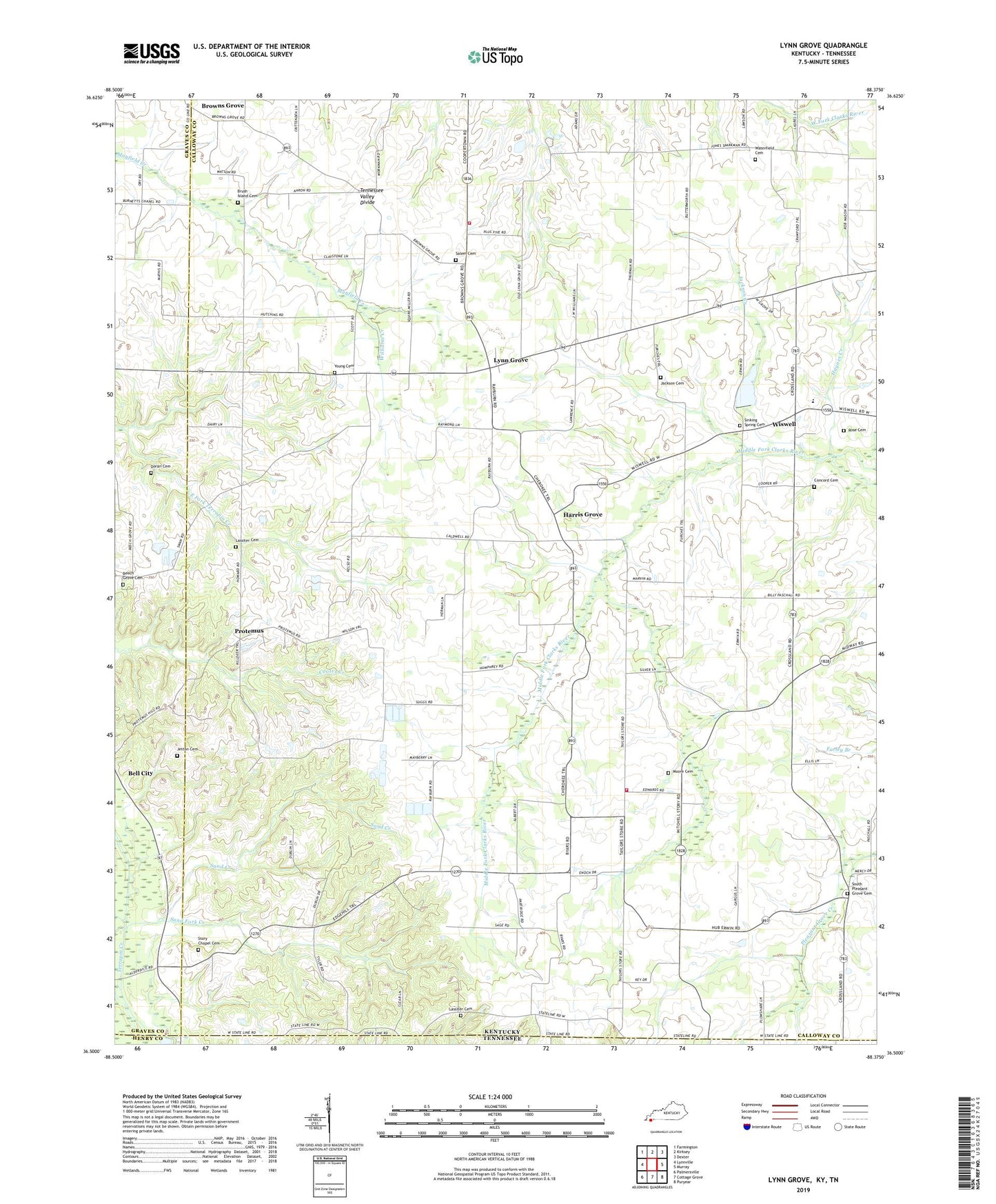
2022 topographic map quadrangle Lynn Grove in the states of Kentucky, Tennessee. Scale: 1:24000. Based on the newly updated USGS 7.5' US Topo map series, this map is in the following counties: Calloway, Graves, Henry. The map contains contour data, water features, and other items you are used to seeing on USGS maps, but also has updated roads and other features. This is the next generation of topographic maps. Printed on high-quality waterproof paper with UV fade-resistant inks.
Quads adjacent to this one:
West: Lynnville
Northwest: Farmington
North: Kirksey
Northeast: Dexter
East: Murray
Southeast: Puryear
South: Cottage Grove
Southwest: Palmersville
Contains the following named places: Beech Grove Cemetery, Beech Grove Church, Browns Grove, Brush Island Cemetery, Calloway County Fire and Rescue Station 6, Calloway County Fire and Rescue Station 8, Concord Cemetery, Crossland, Doran Cemetery, Harris Grove, Haynes Creek, Hazel-Lynn Grove Division, Jackson Cemetery, Jackson Creek, Jetton Cemetery, Lassiter Cemetery, Lynn Grove, Moore Cemetery, Moore Mine, Mount Pleasant Church, Protemus, Providence Church, Rose Cemetery, Salem Cemetery, Salem Church, Sand Creek, Sand Fork Creek, Sinking Spring Cemetery, Sinking Spring Church, South Pleasant Grove Cemetery, South Pleasant Grove Church, Story Chapel, Story Chapel Cemetery, Taylors Store, Waterfield Cemetery, Williams Chapel, Williams Creek, Wiswell, Young Cemetery