MyTopo
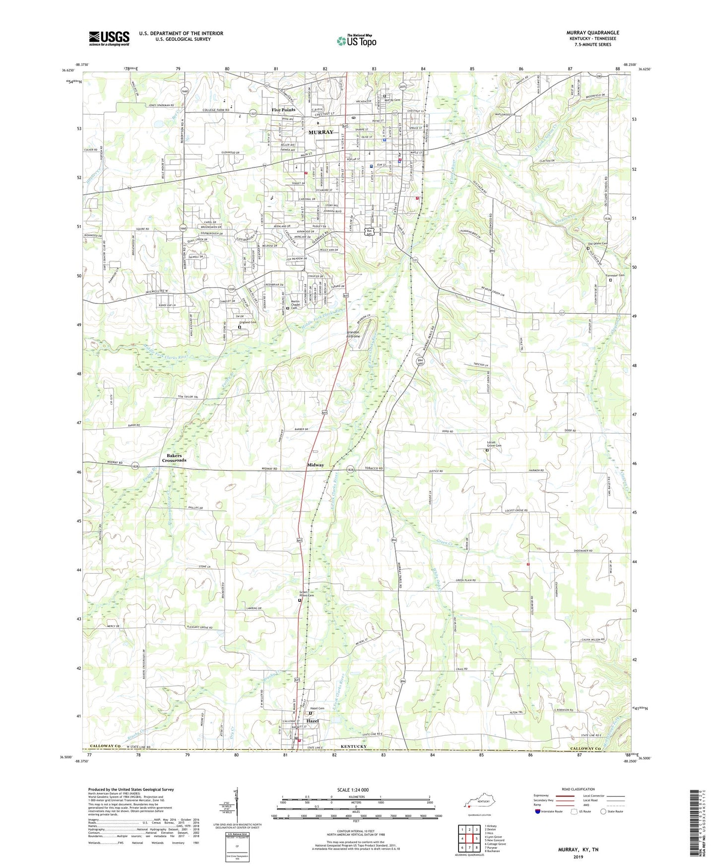
Murray Kentucky US Topo Map
Couldn't load pickup availability
2022 topographic map quadrangle Murray in the state of Kentucky. Scale: 1:24000. Based on the newly updated USGS 7.5' US Topo map series, this map is in the following counties: Calloway, Henry. The map contains contour data, water features, and other items you are used to seeing on USGS maps, but also has updated roads and other features. This is the next generation of topographic maps. Printed on high-quality waterproof paper with UV fade-resistant inks.
Quads adjacent to this one:
West: Lynn Grove
Northwest: Kirksey
North: Dexter
Northeast: Hico
East: New Concord
Southeast: Buchanan
South: Puryear
Southwest: Cottage Grove
Contains the following named places: Austin School, Bakers Crossroads, Brandon Airdrome, Brushy Creek, Calloway County, Calloway County Fire and Rescue Main Station, Calloway County Fire and Rescue Station 9, Calloway County Sheriff's Office, Carter School, City of Hazel, City of Murray, Clayton Creek, Cleanth Brooks Historical Marker, Craigtown, Dry Creek, East Fork Clarks River, East Fork Clayton Creek, East Murray, Emmanuel Church, England Cemetery, Farley Branch, Five Points, Forrester Cemetery, Green Creek, Green Plains Cemetery, Green Plains Church, Halfway, Hazel, Hazel Cemetery, Hazel Post Office, Hazel Volunteer Fire Department, Hickory Grove, Hoke Heliport, Hutson Heliport, Locust Grove, Locust Grove Cemetery, Locust Grove Church, Martin Chapel, Martin Chapel Cemetery, Mason Chapel, Middle Fork Clarks River, Midway, Murray, Murray - Calloway County Hospital, Murray - Calloway County Hospital Ambulance Service, Murray City Cemetery, Murray Division, Murray Fire Department Station 1, Murray Fire Department Station 2, Murray Police Department, Murray Post Office, Murray State University, North Murray, Old Salem, Old Salem Cemetery, Old Salem Church, Outland, Pleasant Grove Creek, Robertson School, South Murray, Steeleville, Stone, The Oaks Country Club, University High School, WBLN-FM (Murray), West Murray, White Oak Creek, ZIP Codes: 42049, 42071


