MyTopo
Maceo Kentucky US Topo Map
Couldn't load pickup availability
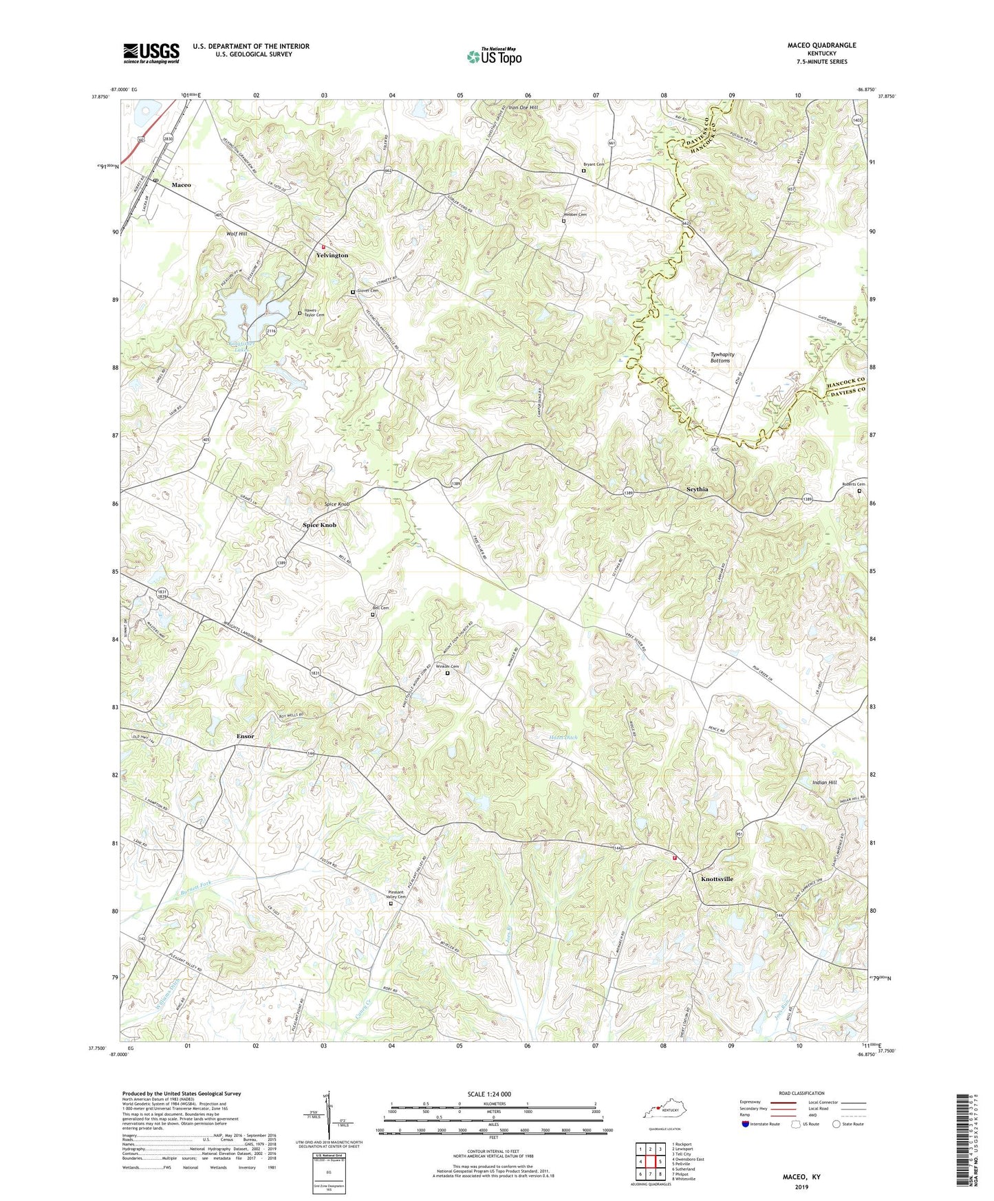
2022 topographic map quadrangle Maceo in the state of Kentucky. Scale: 1:24000. Based on the newly updated USGS 7.5' US Topo map series, this map is in the following counties: Daviess, Hancock. The map contains contour data, water features, and other items you are used to seeing on USGS maps, but also has updated roads and other features. This is the next generation of topographic maps. Printed on high-quality waterproof paper with UV fade-resistant inks.
Quads adjacent to this one:
West: Owensboro East
Northwest: Rockport
North: Lewisport
Northeast: Tell City
East: Pellville
Southeast: Whitesville
South: Philpot
Southwest: Sutherland
This map covers the same area as the classic USGS quad with code o37086g8.
Contains the following named places: Allgood Ditch, Bell Cemetery, Bell Ditch, Bethlehem, Bethlehem Methodist Church, Bryant Cemetery, Carpenters Lake, Ensor, Fork of Pup Creek, Glover Cemetery, Hawes - Taylor Cemetery, Hazel Ditch, Indian Hill, Iron Ore Hill, Kingfisher Lakes, Knottsville, Knottsville Census Designated Place, Knottsville Volunteer Fire Department, Maceo, Maceo Census Designated Place, Maceo Post Office, May String Branch, Mount Zion, Mount Zion Church, Pleasant Valley Christian Church Cemetery, Roberts Cemetery, Roberts Ditch, Saint Williams Church, Scythia, Smeathers Lateral, South Hampton Baptist Church, Spice Knob, Tywhapity Bottoms, Webber Cemetery, Whitesville-Philpot Division, Winkler Cemetery, Wolf Hill, Yelvington, Yelvington Census Designated Place, Yelvington Volunteer Fire Department, ZIP Code: 42355