MyTopo
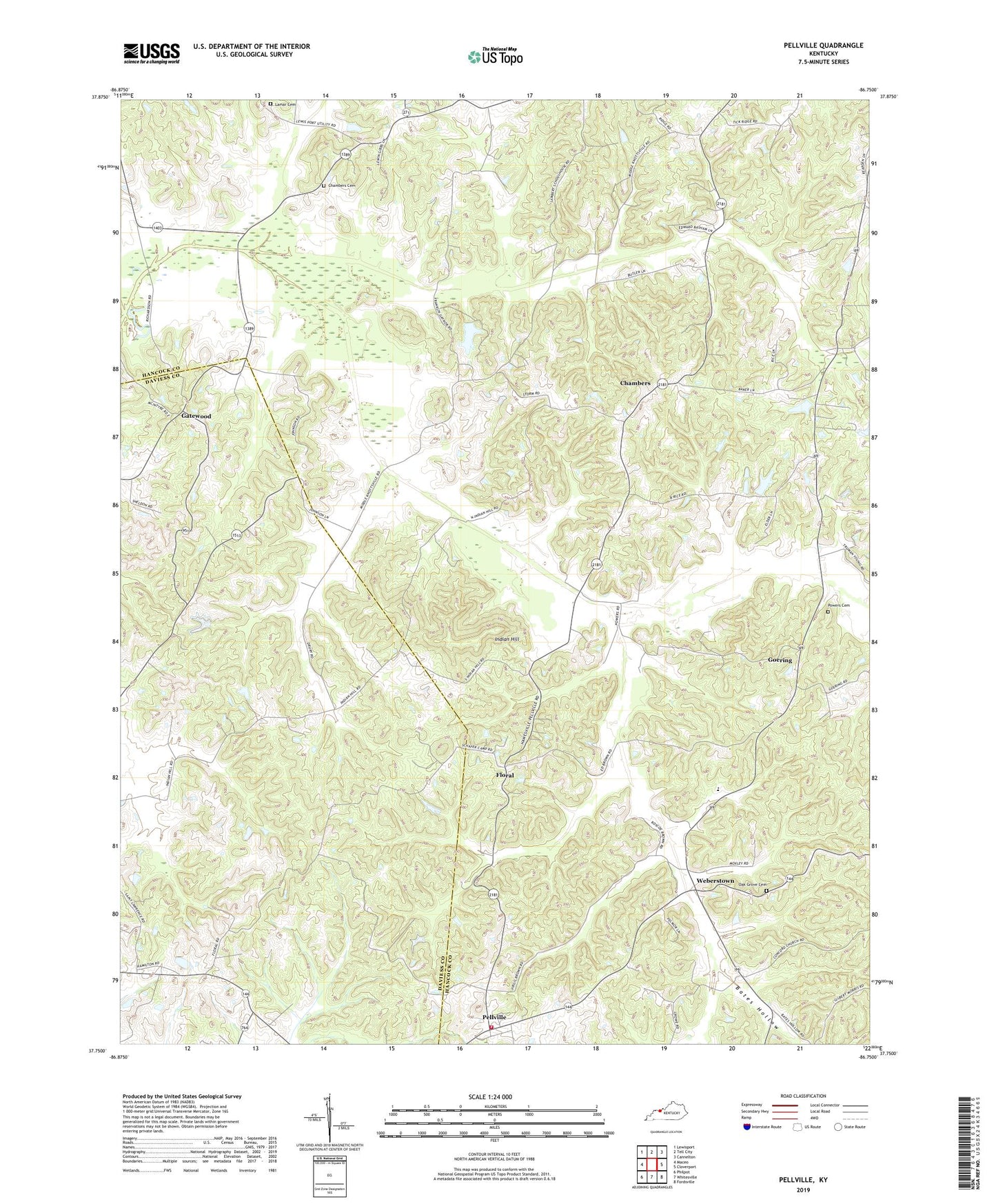
Pellville Kentucky US Topo Map
Couldn't load pickup availability
2022 topographic map quadrangle Pellville in the state of Kentucky. Scale: 1:24000. Based on the newly updated USGS 7.5' US Topo map series, this map is in the following counties: Hancock, Daviess. The map contains contour data, water features, and other items you are used to seeing on USGS maps, but also has updated roads and other features. This is the next generation of topographic maps. Printed on high-quality waterproof paper with UV fade-resistant inks.
Quads adjacent to this one:
West: Maceo
Northwest: Lewisport
North: Tell City
Northeast: Cannelton
East: Cloverport
Southeast: Fordsville
South: Whitesville
Southwest: Philpot
This map covers the same area as the classic USGS quad with code o37086g7.
Contains the following named places: Bates Hollow, Blackford Baptist Church, Caney Creek, Chambers, Chambers Cemetery, Concord Church, Driskell Branch, Flat Branch Horse Fork, Floral, Friendly Grove Church, Gatewood, Goering, Hancock County, Horse Fork, Indian Hill, Lamar Cemetery, Mount Eden Baptist Church, Oak Grove Cemetery, Pellville, Powers Cemetery, Saint Lawrence, Saint Lawrence School, Schafer Memorial Camp, South Hancock Fire Department, Utility, Weberstown, ZIP Code: 42348