MyTopo
Whitesville Kentucky US Topo Map
Couldn't load pickup availability
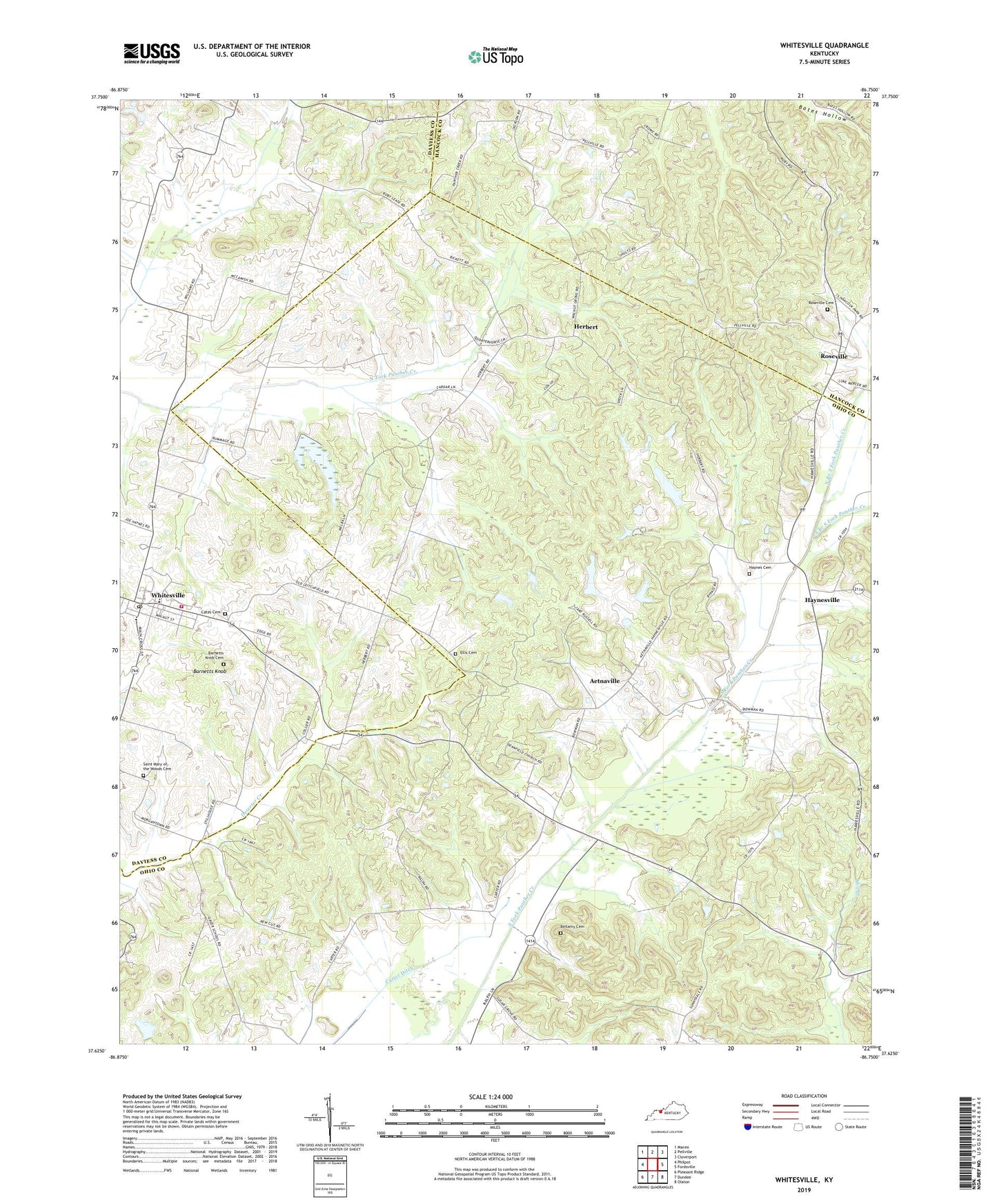
2022 topographic map quadrangle Whitesville in the state of Kentucky. Scale: 1:24000. Based on the newly updated USGS 7.5' US Topo map series, this map is in the following counties: Ohio, Daviess, Hancock. The map contains contour data, water features, and other items you are used to seeing on USGS maps, but also has updated roads and other features. This is the next generation of topographic maps. Printed on high-quality waterproof paper with UV fade-resistant inks.
Quads adjacent to this one:
West: Philpot
Northwest: Maceo
North: Pellville
Northeast: Cloverport
East: Fordsville
Southeast: Olaton
South: Dundee
Southwest: Pleasant Ridge
This map covers the same area as the classic USGS quad with code o37086f7.
Contains the following named places: Aetnaville, Barnetts Knob, Barnetts Knob Cemetery, Bellamy Cemetery, Carter Ditch, Cates Cemetery, City of Whitesville, Daviess County Fire Department Whitesville, Deanefield, Ellis Cemetery, Fordsville Division, Friendship Church, Haynes Cemetery Number 2, Haynesville, Herbert, North Branch South Fork Panther Creek, Old Panther Church, Reynolds Station, Roseville, Roseville Cemetery, Saint Mary of the Woods Cemetery, Saint Thomas Church, South Branch South Fork Panther Creek, West Point Baptist Church, Whitesville, Whitesville Post Office, Zion Church, ZIP Codes: 42368, 42378