MyTopo
Madisonville West Kentucky US Topo Map
Couldn't load pickup availability
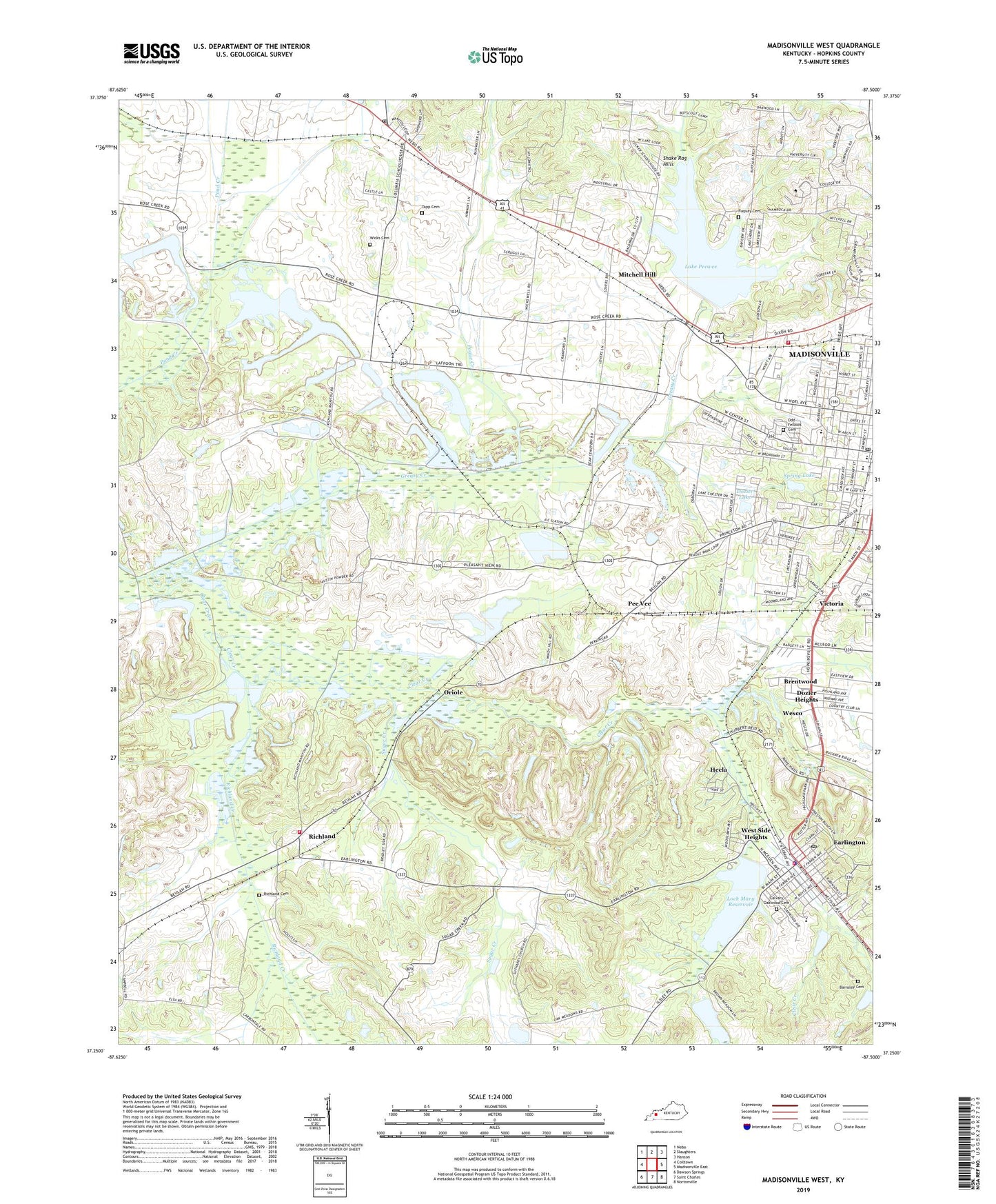
2022 topographic map quadrangle Madisonville West in the state of Kentucky. Scale: 1:24000. Based on the newly updated USGS 7.5' US Topo map series, this map is in the following counties: Hopkins. The map contains contour data, water features, and other items you are used to seeing on USGS maps, but also has updated roads and other features. This is the next generation of topographic maps. Printed on high-quality waterproof paper with UV fade-resistant inks.
Quads adjacent to this one:
West: Coiltown
Northwest: Nebo
North: Slaughters
Northeast: Hanson
East: Madisonville East
Southeast: Nortonville
South: Saint Charles
Southwest: Dawson Springs
This map covers the same area as the classic USGS quad with code o37087c5.
Contains the following named places: Army of Six Historical Marker, Barnsley Cemetery, Brentwood, Browns Lake, Calvary Oakwood Cemetery, Carters Chapel, City of Earlington, City of Madisonville, Cumberland Church, Dozier Heights, Dozier Lake, Earlington, Earlington Fire Department, Earlington Historical Marker, Earlington Police Department, Earlington Post Office, Fuquay Cemetery, Greasy Creek, Hecla, Hopkins County, Kington Lake, Lake Peewee, Loch Mary Reservoir, Madisonville Fire Department Station 3, Madisonville Post Office, Manitou, Manitou Post Office, Mitchell Hill, Oak Grove Church, Odd Fellows Cemetery, Oriole, Oriole Mine, Pee Vee, Pleasant Grove Church, Pleasant View, Pleasant View Church, Pleasant View Lake, Pleasant View Mine, Pogue Creek, Richland, Richland Cemetery, Richland Church, Richland Creek, Richland Fire Department, Seminary School, Spring Lake, Steubens Lick Historical Marker, Sugar Creek, Tapp Cemetery Number 1, Twin Lakes, Victoria, Wesco, West Side Heights, Wicks Cemetery, Wicks Well, WLCN-TV (Madisonville), WTTL-AM (Madisonville), Zion Church, ZIP Codes: 42410, 42436