MyTopo
Hanson Kentucky US Topo Map
Couldn't load pickup availability
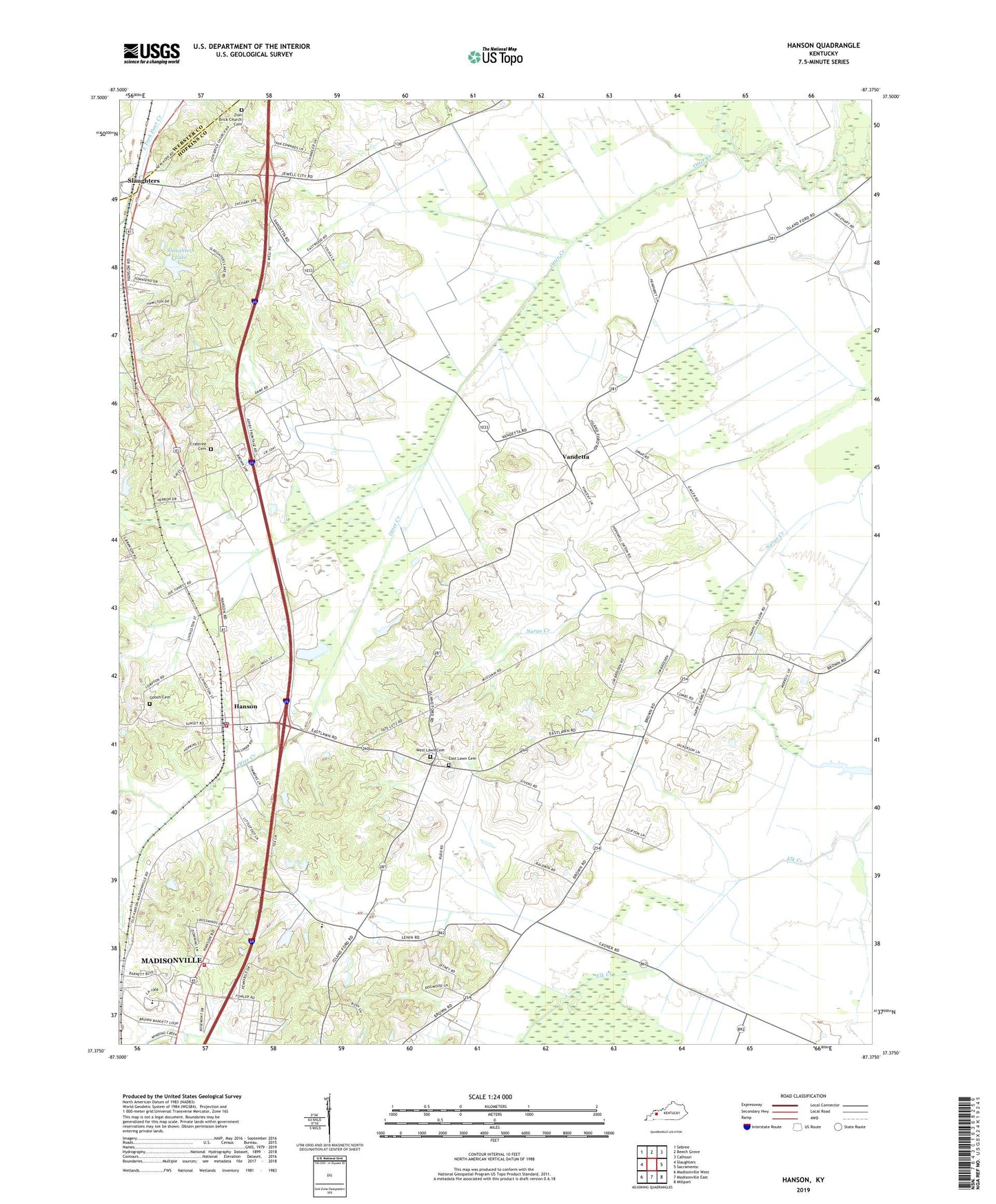
2022 topographic map quadrangle Hanson in the state of Kentucky. Scale: 1:24000. Based on the newly updated USGS 7.5' US Topo map series, this map is in the following counties: Hopkins, Webster. The map contains contour data, water features, and other items you are used to seeing on USGS maps, but also has updated roads and other features. This is the next generation of topographic maps. Printed on high-quality waterproof paper with UV fade-resistant inks.
Quads adjacent to this one:
West: Slaughters
Northwest: Sebree
North: Beech Grove
Northeast: Calhoun
East: Sacramento
Southeast: Millport
South: Madisonville East
Southwest: Madisonville West
This map covers the same area as the classic USGS quad with code o37087d4.
Contains the following named places: City of Hanson, Crabtree Cemetery, Crossroad Chapel, East Lawn Cemetery, Emberry Church, Gooch Cemetery, Hanson, Hanson Division, Hanson Historical Marker, Hanson Post Office, Hanson Volunteer Fire Department, Madisonville Fire Department Station 4, New Hope Church, Old Salem Holiness Church, Partisan Rangers Historical Marker, Pritchetts Chapel, Providence Church, Slaughters Lake, Vandetta, West Lawn Cemetery, Zion Brick Church Cemetery, Zion Church, ZIP Code: 42413