MyTopo
Mason Kentucky US Topo Map
Couldn't load pickup availability
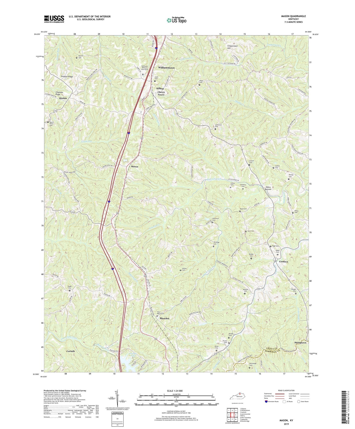
2022 topographic map quadrangle Mason in the state of Kentucky. Scale: 1:24000. Based on the newly updated USGS 7.5' US Topo map series, this map is in the following counties: Grant, Harrison. The map contains contour data, water features, and other items you are used to seeing on USGS maps, but also has updated roads and other features. This is the next generation of topographic maps. Printed on high-quality waterproof paper with UV fade-resistant inks.
Quads adjacent to this one:
West: Lawrenceville
Northwest: Elliston
North: Williamstown
Northeast: Goforth
East: Berry
Southeast: Breckinridge
South: Sadieville
Southwest: New Columbus
This map covers the same area as the classic USGS quad with code o38084e5.
Contains the following named places: Ackman Cemetery, Anness Cemetery, Blanchet, Brewsaugh - Murphy Cemetery, Brewsaugh Cemetery, Brooks Cemetery, Bruce Cemetery, Camp Northward, Catlick Cemetery, Cherry Creek School, Cherry Grove, Clark Cemetery, Collier Cemetery, Coopertown Hill, Cordova, Corinth Division, Corinth Lake, Crouch Cemetery, Dunn Cemetery, Dunn Mazie Run, Elizabeth Church, Grassy Run Church, Heekin, Hilltop, Kentucky Veterans Cemetery North, Lawrence Cemetery, Layton Chapel, Lystra Church, Mason, Mason School, Moon Cemetery, Morgan Cemetery, Mount Oliver Cemetery, Mount Olivet Church, Mount Pleasant Church, North Fork Lick Creek, Oak Ridge Church, Odors Bottom, Page Cemetery, Phillips Cemetery, Risen Cemetery, Saint Marys Cemetery, Sheriff Cemetery, Shiloh Church, Simpson Ridge, South Fork Lick Creek Branch, Steger Cemetery, Stringtown, Webb Cemetery, Williamstown Creek, Windings Cemetery, ZIP Code: 41097