MyTopo
Lawrenceville Kentucky US Topo Map
Couldn't load pickup availability
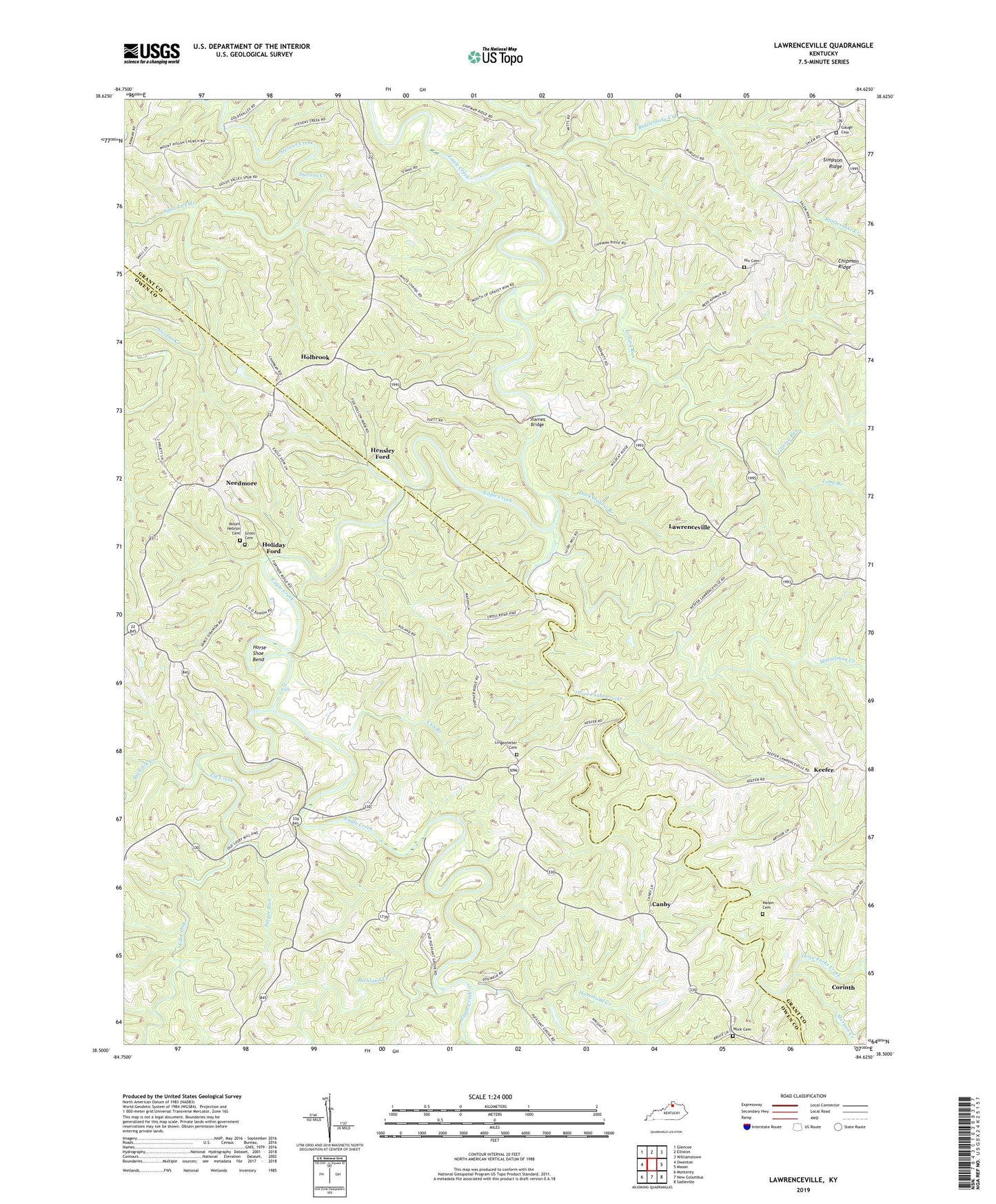
2022 topographic map quadrangle Lawrenceville in the state of Kentucky. Scale: 1:24000. Based on the newly updated USGS 7.5' US Topo map series, this map is in the following counties: Grant, Owen. The map contains contour data, water features, and other items you are used to seeing on USGS maps, but also has updated roads and other features. This is the next generation of topographic maps. Printed on high-quality waterproof paper with UV fade-resistant inks.
Quads adjacent to this one:
West: Owenton
Northwest: Glencoe
North: Elliston
Northeast: Williamstown
East: Mason
Southeast: Sadieville
South: New Columbus
Southwest: Monterey
This map covers the same area as the classic USGS quad with code o38084e6.
Contains the following named places: Bethany Church, Buck Elk Creek, Canby, Canby Post Office, Chipman Ridge, Coxs Branch, Cub Branch, Dark Hollow Branch, Elk Creek, Elk Riffle, Gaugh Cemetery, Grassy Run, Gross Cemetery, Hammond Creek, Hensley Ford, Holbrook, Holiday Ford, Horse Shoe Bend, Keefer, Lawrenceville, Lingenfelter Cemetery, Long Branch, Lusby Mill, Lusby Post Office, Lusbys Mill School, Margaret Post Office, Mason Cemetery, Morgan Creek, Mount Hebron Baptist Church, Mount Hebron Cemetery, Musselman Creek, Musselshoals Church, Needmore, Nix Cemetery, Ram Branch, Richland Creek, Salem United Methodist Church, Sand Lick Branch, Singer Run, Starnes Bridge, Three Forks Creek, Waldrop School, White Chapel, Work Cemetery