MyTopo
Lodiburg Kentucky US Topo Map
Couldn't load pickup availability
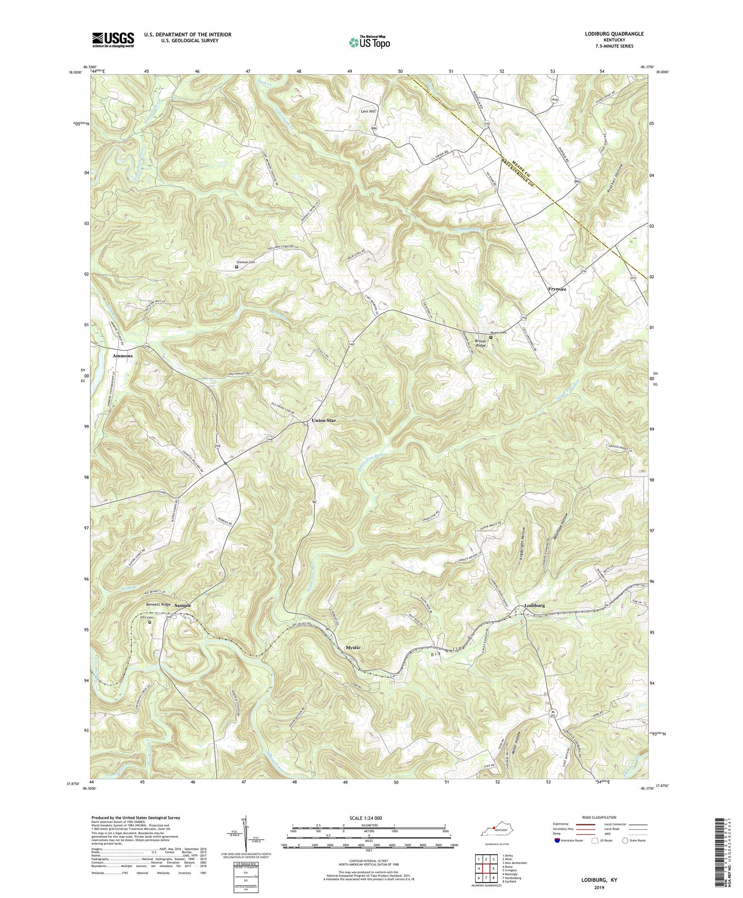
2022 topographic map quadrangle Lodiburg in the state of Kentucky. Scale: 1:24000. Based on the newly updated USGS 7.5' US Topo map series, this map is in the following counties: Breckinridge, Meade. The map contains contour data, water features, and other items you are used to seeing on USGS maps, but also has updated roads and other features. This is the next generation of topographic maps. Printed on high-quality waterproof paper with UV fade-resistant inks.
Quads adjacent to this one:
West: Rome
Northwest: Derby
North: Alton
Northeast: New Amsterdam
East: Irvington
Southeast: Garfield
South: Hardinsburg
Southwest: Mattingly
This map covers the same area as the classic USGS quad with code o37086h4.
Contains the following named places: Ammons, Argabright Hollow, Bennett Ridge, Bruner Cemetery Number 3, Bruner Ridge, Buck Creek, Caney Fork, Dry Valley, Dry Valley Baptist Church, Flint Run, Frymire, Frymire School, Jolly Cemetery, Levi Hill, Lodiburg, Manning Crossing, Mystic, Newhope Hollow, Preston, Sample, Shelman Cemetery, Shot Pouch Creek, Sugar Tree Run, Union Star, Walnut Grove Church, ZIP Code: 40171