MyTopo
Midway Kentucky US Topo Map
Couldn't load pickup availability
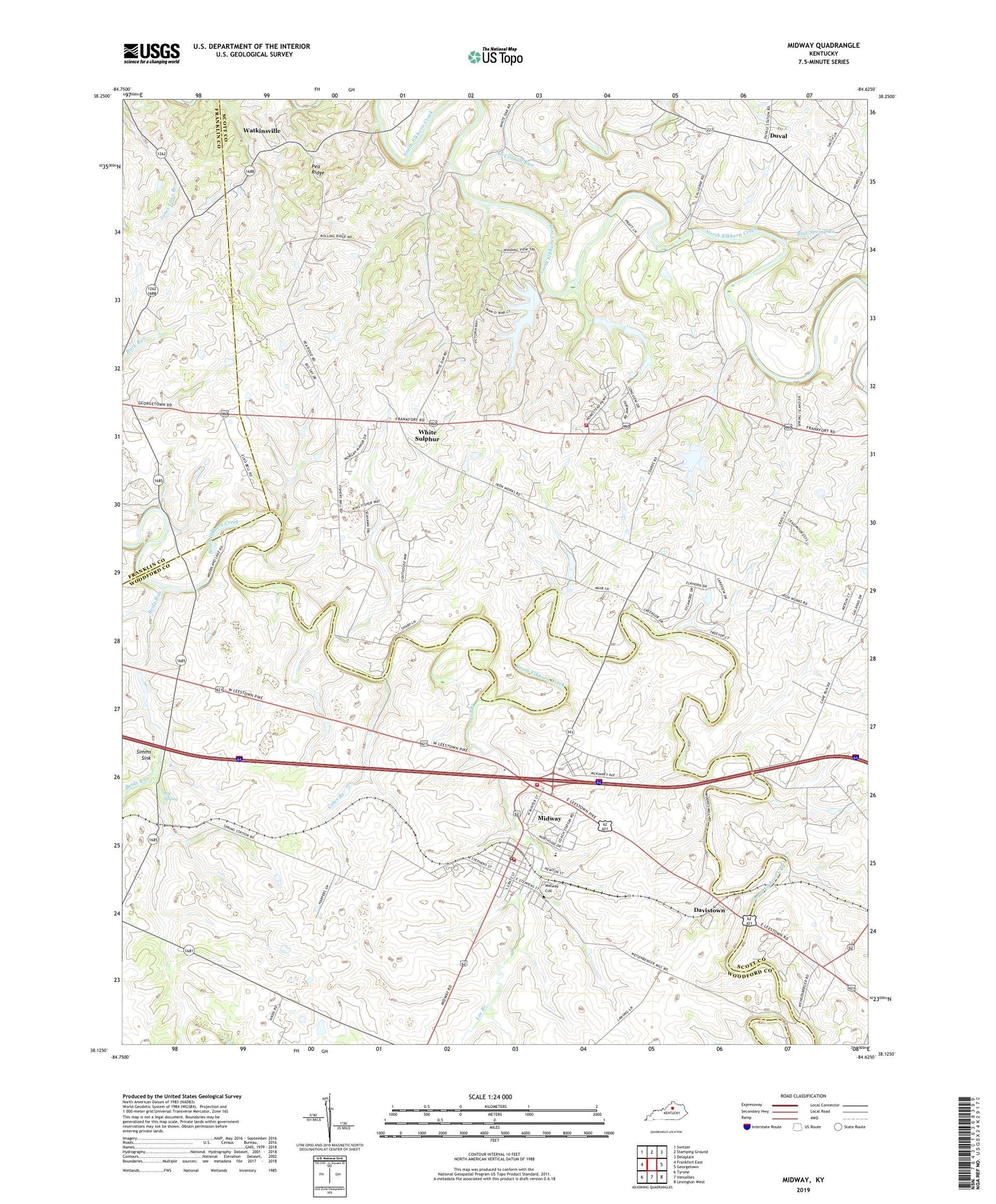
2022 topographic map quadrangle Midway in the state of Kentucky. Scale: 1:24000. Based on the newly updated USGS 7.5' US Topo map series, this map is in the following counties: Scott, Woodford, Franklin. The map contains contour data, water features, and other items you are used to seeing on USGS maps, but also has updated roads and other features. This is the next generation of topographic maps. Printed on high-quality waterproof paper with UV fade-resistant inks.
Quads adjacent to this one:
West: Frankfort East
Northwest: Switzer
North: Stamping Ground
Northeast: Delaplain
East: Georgetown
Southeast: Lexington West
South: Versailles
Southwest: Tyrone
This map covers the same area as the classic USGS quad with code o38084b6.
Contains the following named places: Aspen Grove Farm, Barbeque Spring, Beals Run, Big Spring, Big Spring Church, Big Spring Railroad Station, Blue Spring Branch, Buck Run Baptist Church, City of Midway, Coles Branch, Coles Tavern, Davis Depot, Davistown, Duval, Elkwood Farm, Elliot Farm, Lee Branch, Lindsay Spring, Mapleton Farm, McConnell Run, Midway, Midway Division, Midway Fire / Rescue, Midway Post Office, Nantura Farm, Orphans School, Pea Ridge, Pine Grove Farm, Pospect Hill Farm, Saint Francis Mission, Sand Lick, Scott County Fire Department Station 5, Sherwood Farm, Simms Sink, Sodom, Spring Garden Farm, Spring Station, Spring Station Post Office, Stockwood Farm, Tutts Tavern, Watkinsville, Waverly Farm, Weisenberger Mill, White Sulphur, Woodburn Farm, Woodford County Fire Department Station 4, Zebulah Church, ZIP Code: 40347