MyTopo
Georgetown Kentucky US Topo Map
Couldn't load pickup availability
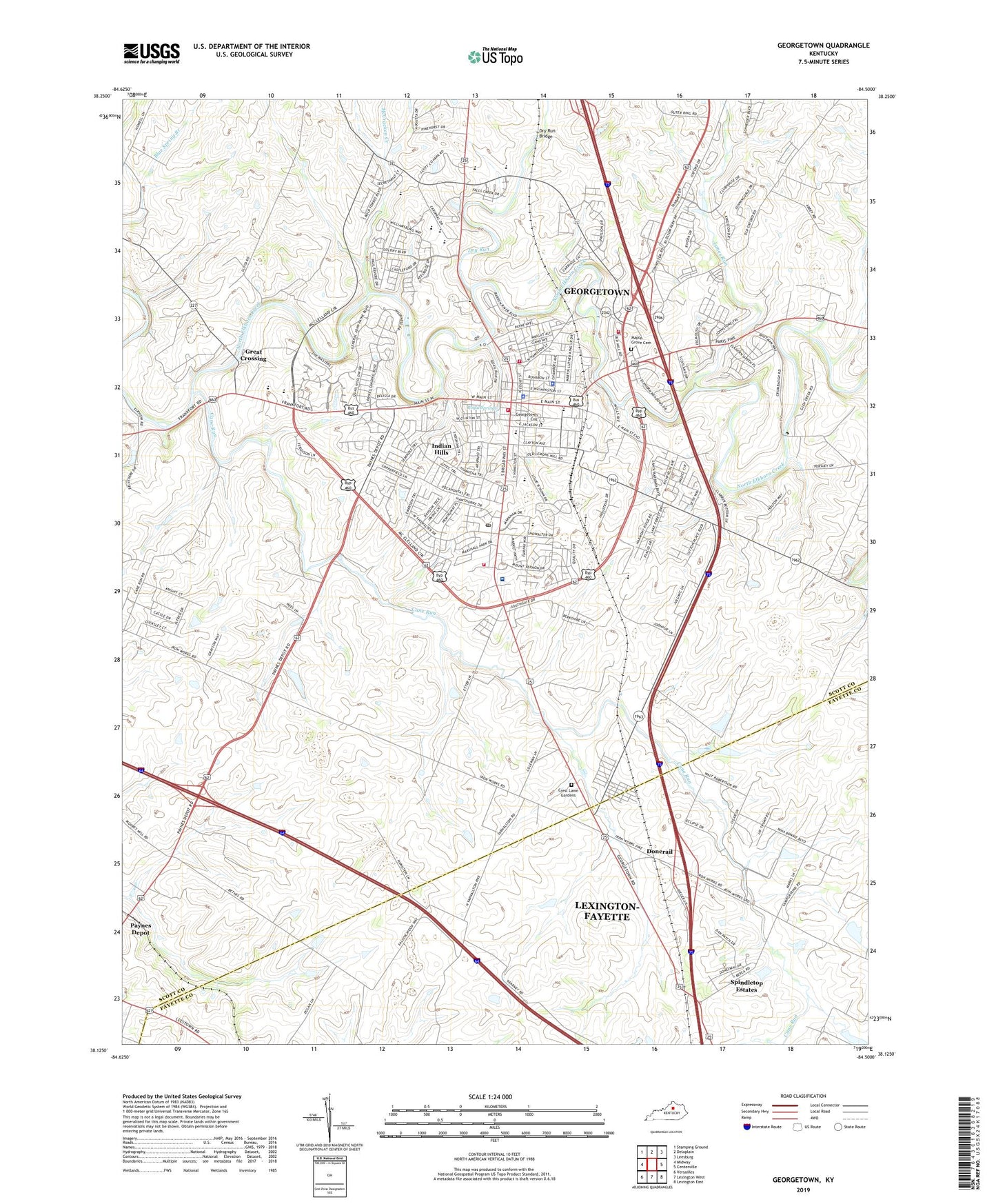
2022 topographic map quadrangle Georgetown in the state of Kentucky. Scale: 1:24000. Based on the newly updated USGS 7.5' US Topo map series, this map is in the following counties: Scott, Fayette. The map contains contour data, water features, and other items you are used to seeing on USGS maps, but also has updated roads and other features. This is the next generation of topographic maps. Printed on high-quality waterproof paper with UV fade-resistant inks.
Quads adjacent to this one:
West: Midway
Northwest: Stamping Ground
North: Delaplain
Northeast: Leesburg
East: Centerville
Southeast: Lexington East
South: Lexington West
Southwest: Versailles
This map covers the same area as the classic USGS quad with code o38084b5.
Contains the following named places: Berea Church, Bethel Church, Cane Run, Cane Run Church, Cardome Academy, City of Georgetown, Clabber Bottom, Crest Lawn Memorial Cemetery, Donerail, Dry Run, Dry Run Bridge, Garth School, Georgetown, Georgetown - Scott County Emergency Medical Services, Georgetown College, Georgetown Community Hospital, Georgetown Division, Georgetown Fire and Rescue Station 1, Georgetown Fire and Rescue Station 2, Georgetown Fire and Rescue Station 3, Georgetown Police Department, Georgetown Post Office, Great Crossing, Herdon, Indian Hills, Kentucky State Horse Park, Lancelot Estates, Lanes Run, Man O' War Historical Marker, Maple Grove Cemetery, Marshall Field, McCracken Creek, Miller Run, Paynes Depot, Peak, Royal Springs, Scott County Fire Department Station 6, Scott County Sheriff's Office, Shiff, Spindletop Estates, Steeplechase Racetrack, Stone Hedge Estates, University of Kentucky Agricultural Experimental Station, WAXU-AM (Georgetown), WRVG-FM (Georgetown), ZIP Code: 40324