MyTopo
Stamping Ground Kentucky US Topo Map
Couldn't load pickup availability
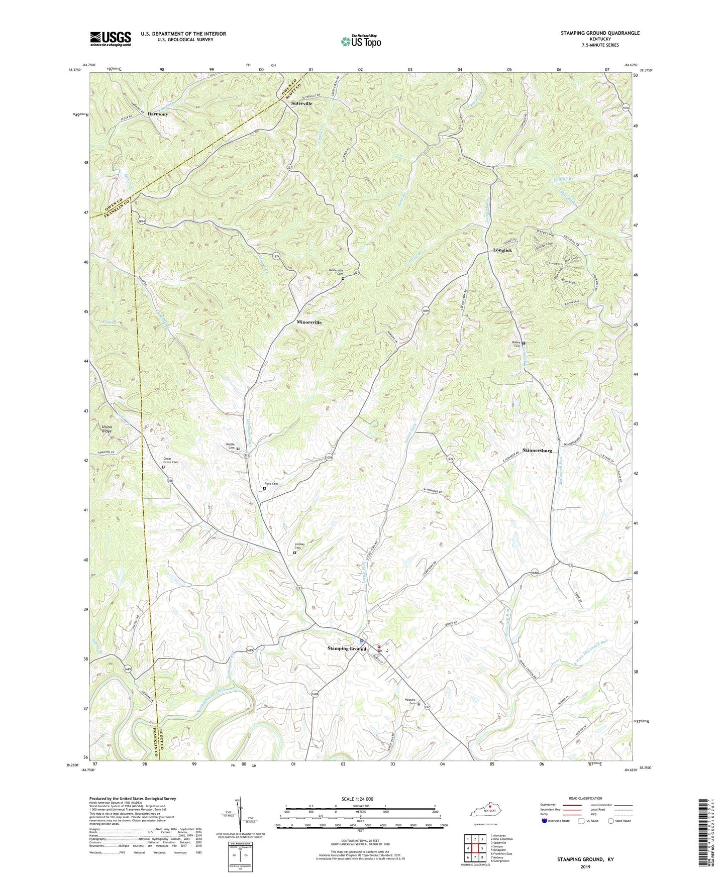
2022 topographic map quadrangle Stamping Ground in the state of Kentucky. Scale: 1:24000. Based on the newly updated USGS 7.5' US Topo map series, this map is in the following counties: Scott, Franklin, Owen. The map contains contour data, water features, and other items you are used to seeing on USGS maps, but also has updated roads and other features. This is the next generation of topographic maps. Printed on high-quality waterproof paper with UV fade-resistant inks.
Quads adjacent to this one:
West: Switzer
Northwest: Monterey
North: New Columbus
Northeast: Sadieville
East: Delaplain
Southeast: Georgetown
South: Midway
Southwest: Frankfort East
This map covers the same area as the classic USGS quad with code o38084c6.
Contains the following named places: Allsup Branch, Bond Cemetery, Caesarea Church, Cedar Grove Baptist Church, Cedar Grove Cemetery, City of Stamping Ground, Corinth Christian Church, East Fork McConnell Run, Griffith Branch, Harmony, Harmony Post Office, Head of Cedar, Hess Branch, Lecomptes Run, Lindsay Cemetery, Locust Fork, Longlick, Longlick Branch, Masonic Cemetery, Minorsville, Minorsville Cemetery, Oakland Christian Church, Riddle Cemetery, Robey Cemetery, Sebree Branch, Skinnersburg, Stamping Ground, Stamping Ground Division, Stamping Ground Police Department, Stamping Ground Post Office, Stamping Ground Volunteer Fire Department, Suterville, Sutterville Post Office, ZIP Code: 40379