MyTopo
Morgantown Kentucky US Topo Map
Couldn't load pickup availability
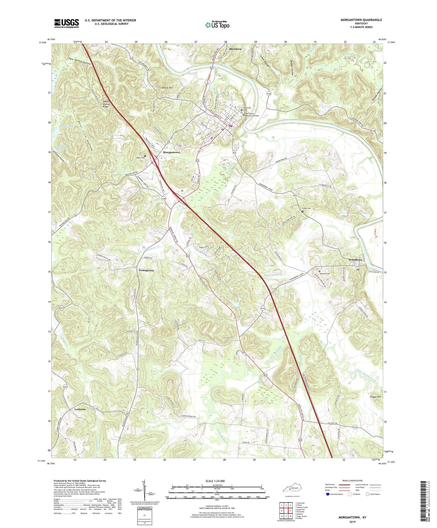
2022 topographic map quadrangle Morgantown in the state of Kentucky. Scale: 1:24000. Based on the newly updated USGS 7.5' US Topo map series, this map is in the following counties: Butler, Warren. The map contains contour data, water features, and other items you are used to seeing on USGS maps, but also has updated roads and other features. This is the next generation of topographic maps. Printed on high-quality waterproof paper with UV fade-resistant inks.
Quads adjacent to this one:
West: South Hill
Northwest: Cromwell
North: Flener
Northeast: Welchs Creek
East: Riverside
Southeast: Hadley
South: Sugar Grove
Southwest: Quality
This map covers the same area as the classic USGS quad with code o37086b6.
Contains the following named places: Allens Hill, Big Branch, Black Swamp Branch, Butler County, Butler County Ambulance Service, Butler County Sheriff's Office, Carved Rock, Carved Rock Church, City of Morgantown, City of Woodbury, Clifty Branch, Cook Cemetery, Cool Spring Church, Cools Spring, Deer Lick Hollow, Hagan Shanty Ridge, Hill Haven Memory Gardens, Hocker Branch, Leetown, Little Bluff Lake, Little Muddy Church, Lock Dam Number 4, Long Branch, Lower Hollow, Middle Hollow, Middle Lake, Mooretown, Morgantown, Morgantown Division, Morgantown Fire Department, Morgantown Police Department, Morgantown Post Office, Newton Cemetery, Pipe Spring Hollow, Pleasant Rock Church, Possum Hollow, Renfrow Creek, Riverview Cemetery, Sandy Creek Church, Stillhouse Hollow, Wade Cemetery, Welch Creek, WLBQ-AM (Morgantown), Woodbury, Woodbury Post Office, Youngtown, ZIP Code: 42261