MyTopo
Quality Kentucky US Topo Map
Couldn't load pickup availability
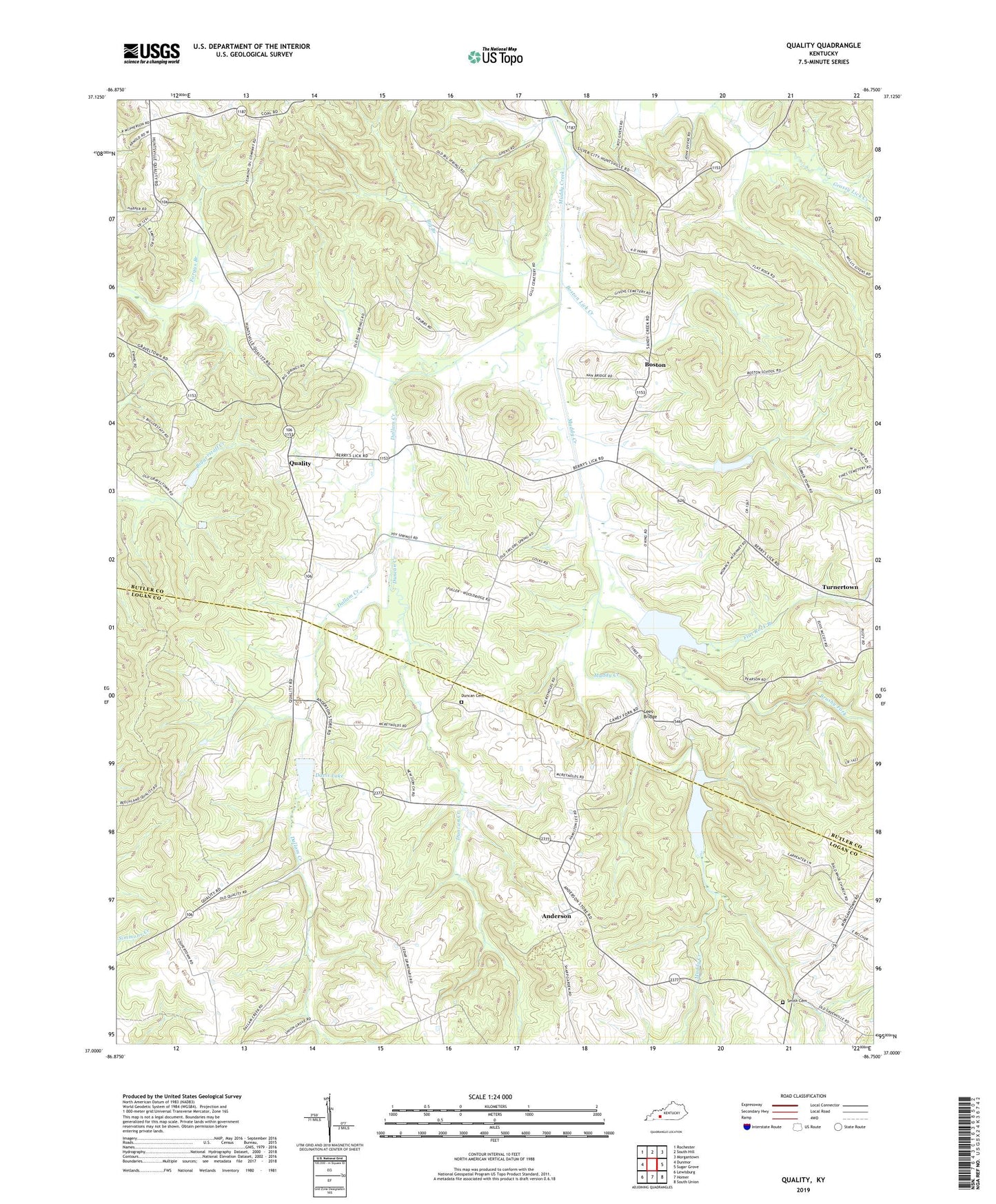
2022 topographic map quadrangle Quality in the state of Kentucky. Scale: 1:24000. Based on the newly updated USGS 7.5' US Topo map series, this map is in the following counties: Butler, Logan. The map contains contour data, water features, and other items you are used to seeing on USGS maps, but also has updated roads and other features. This is the next generation of topographic maps. Printed on high-quality waterproof paper with UV fade-resistant inks.
Quads adjacent to this one:
West: Dunmor
Northwest: Rochester
North: South Hill
Northeast: Morgantown
East: Sugar Grove
Southeast: South Union
South: Homer
Southwest: Lewisburg
This map covers the same area as the classic USGS quad with code o37086a7.
Contains the following named places: Alum Spring School, Anderson, Bald Knob Church, Big Branch, Big Spring School, Boston, Boston Lick Creek, Brushy Fork, Caney Fork School, Concord Church, Dallam Creek, Davis Lake, Duncan Cemetery, Duncan Creek, Flat Rock Branch, Gupton Grove, Hickory Grove Church, Lees Bridge, Mount Zion, Mount Zion School, Pauline, Quality, Sand Spring Church, Smith's Cemetery, Townsville, Toy Spring, Toy Spring School, Turnertown, Union Grove School, Union School, Union Zion School