MyTopo
Ballardsville Kentucky US Topo Map
Couldn't load pickup availability
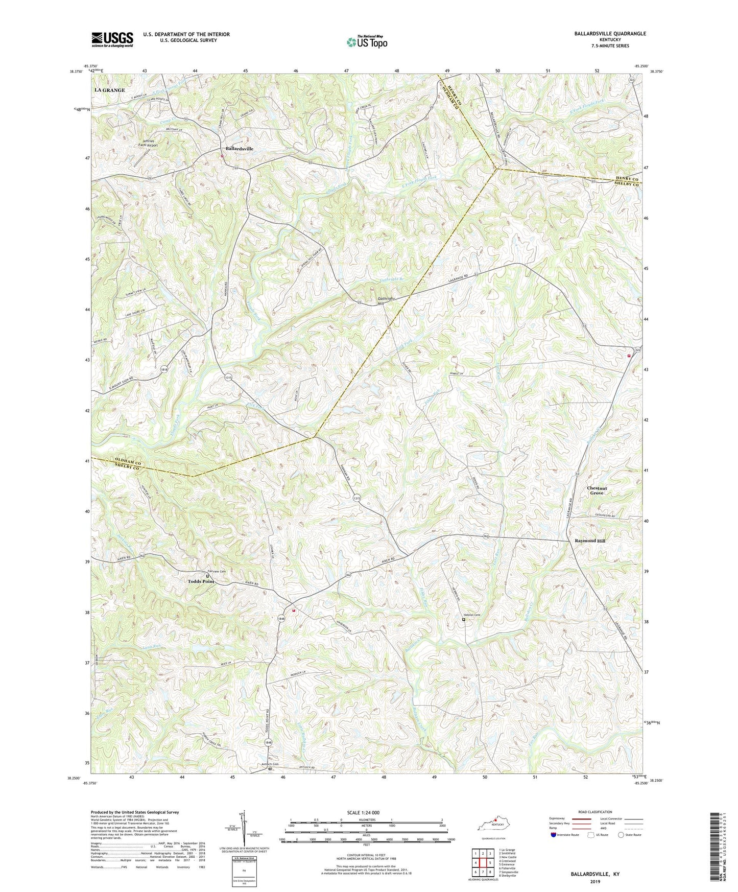
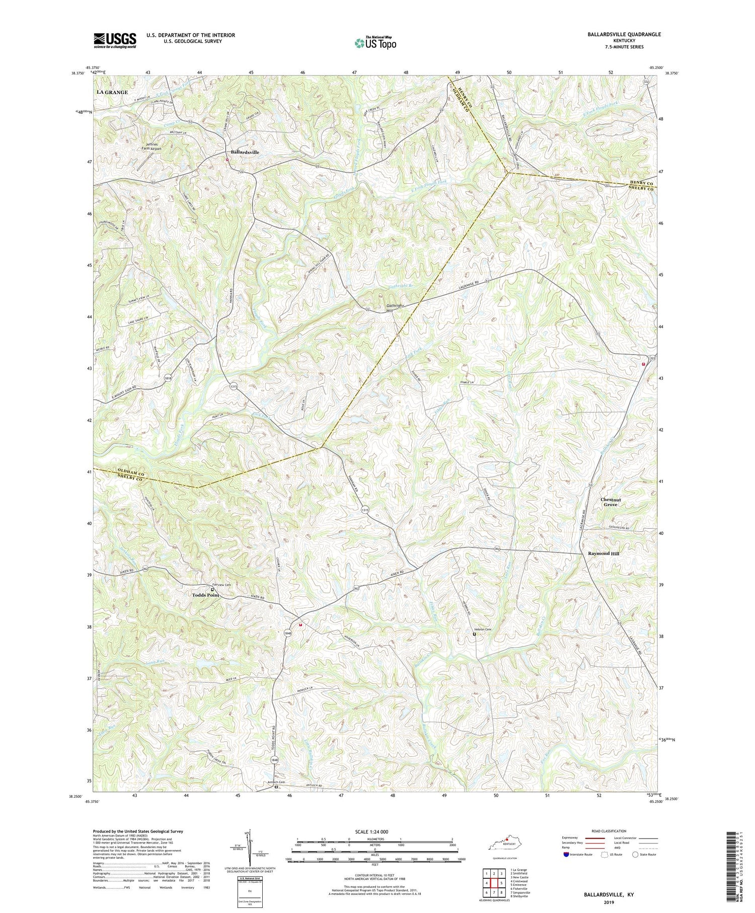
2022 topographic map quadrangle Ballardsville in the state of Kentucky. Scale: 1:24000. Based on the newly updated USGS 7.5' US Topo map series, this map is in the following counties: Shelby, Oldham, Henry. The map contains contour data, water features, and other items you are used to seeing on USGS maps, but also has updated roads and other features. This is the next generation of topographic maps. Printed on high-quality waterproof paper with UV fade-resistant inks.
Quads adjacent to this one:
West: Crestwood
Northwest: La Grange
North: Smithfield
Northeast: New Castle
East: Eminence
Southeast: Shelbyville
South: Simpsonville
Southwest: Fisherville
This map covers the same area as the classic USGS quad with code o38085c3.
Contains the following named places: Antioch Cemetery, Antioch Christian Church, Ballardsville, Ballardsville Fire Department, Camp Creek, Chestnut Grove, Chestnut Grove Grange Hall, Chestnut Grove Post Office, Dover Baptist Church, East Fork Floyds Fork, Fairview Cemetery, Fibles Run, Gathright Branch, Gathright Hill, Gleneyrie School, Hebron Cemetery, Hebron Church, Jeffries Farm Airport, Lick Fork, Lincolnfellow Hill, Lutz Run, Mallory, Mount Pleasant Church, North Fork Floyds Fork, Olivet Presbyterian Church, Pinhook Church, Raymond Hill, Sandusky School, Shelby County Baptist Camp, Shelby County Fire Department Station 5, Simpsonville Rural Fire Protection District - Station 2, Todds Point, Todds Point Post Office, Zion