MyTopo
Eminence Kentucky US Topo Map
Couldn't load pickup availability
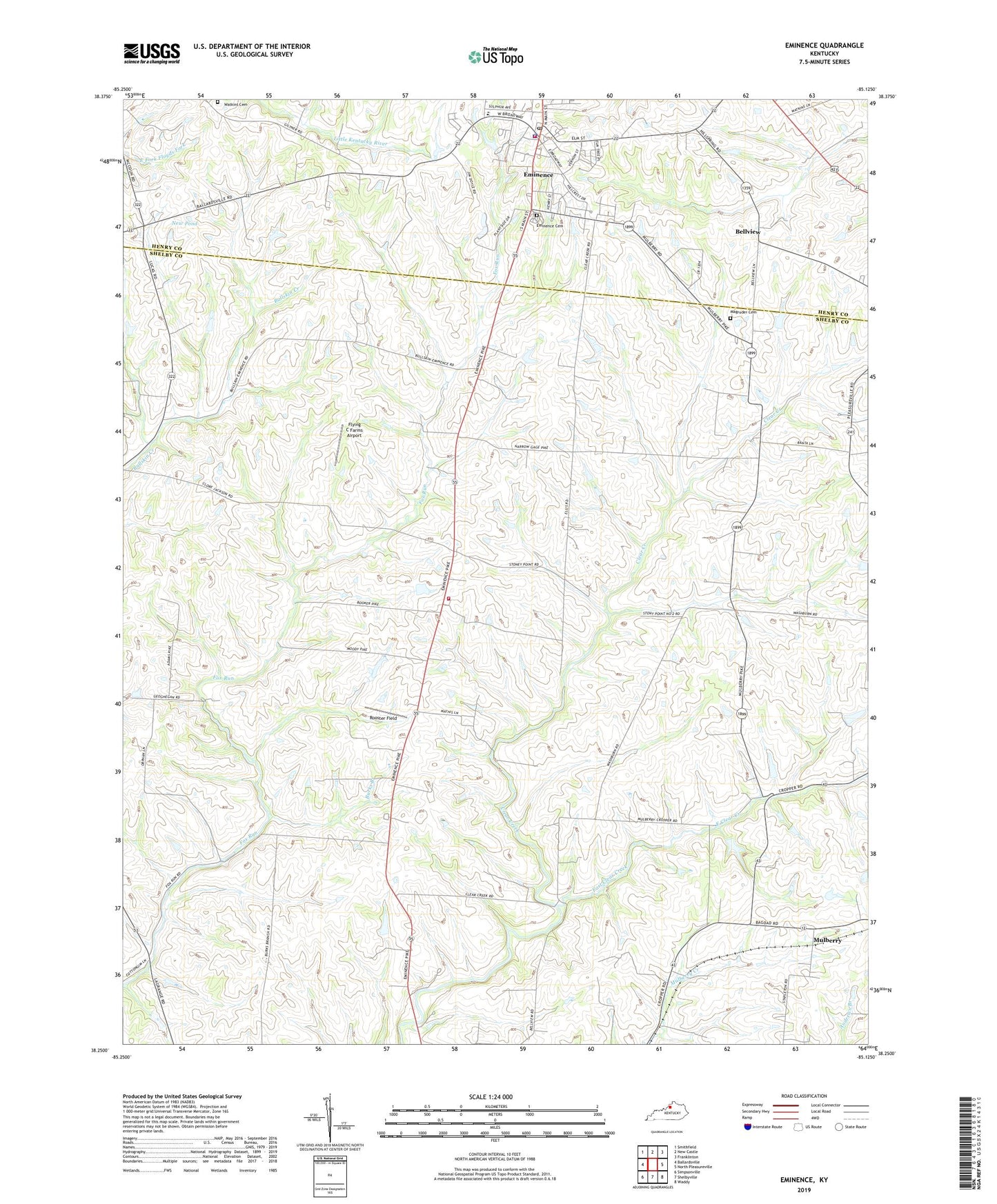
2022 topographic map quadrangle Eminence in the state of Kentucky. Scale: 1:24000. Based on the newly updated USGS 7.5' US Topo map series, this map is in the following counties: Shelby, Henry. The map contains contour data, water features, and other items you are used to seeing on USGS maps, but also has updated roads and other features. This is the next generation of topographic maps. Printed on high-quality waterproof paper with UV fade-resistant inks.
Quads adjacent to this one:
West: Ballardsville
Northwest: Smithfield
North: New Castle
Northeast: Franklinton
East: North Pleasureville
Southeast: Waddy
South: Shelbyville
Southwest: Simpsonville
This map covers the same area as the classic USGS quad with code o38085c2.
Contains the following named places: Bayard Post Office, Bellview, Burks Branch, Burks Branch Church, Burks Branch School, City of Eminence, East Clear Creek, Eminence, Eminence Cemetery, Eminence Fire Department, Eminence Police Department, Eminence Post Office, Eminence Railroad Station, Flying C Farms Airport, Hill Spring Post Office, Magruder Cemetery, Mulberry, Mulberry Railroad Station, Mulberry School, New Pond, Nugent Post Office, Pleasant View Church, Rooster Field, School Number Thirty-Two, Shady Grove Sanitarium, Shelby County Fire Department Station 3, Todds Pond, Upper Burks Branch School, Wall Spring, Watkins Cemetery, WKXF-FM (Eminence), WXLN-AM (Eminence)