MyTopo
North Middletown Kentucky US Topo Map
Couldn't load pickup availability
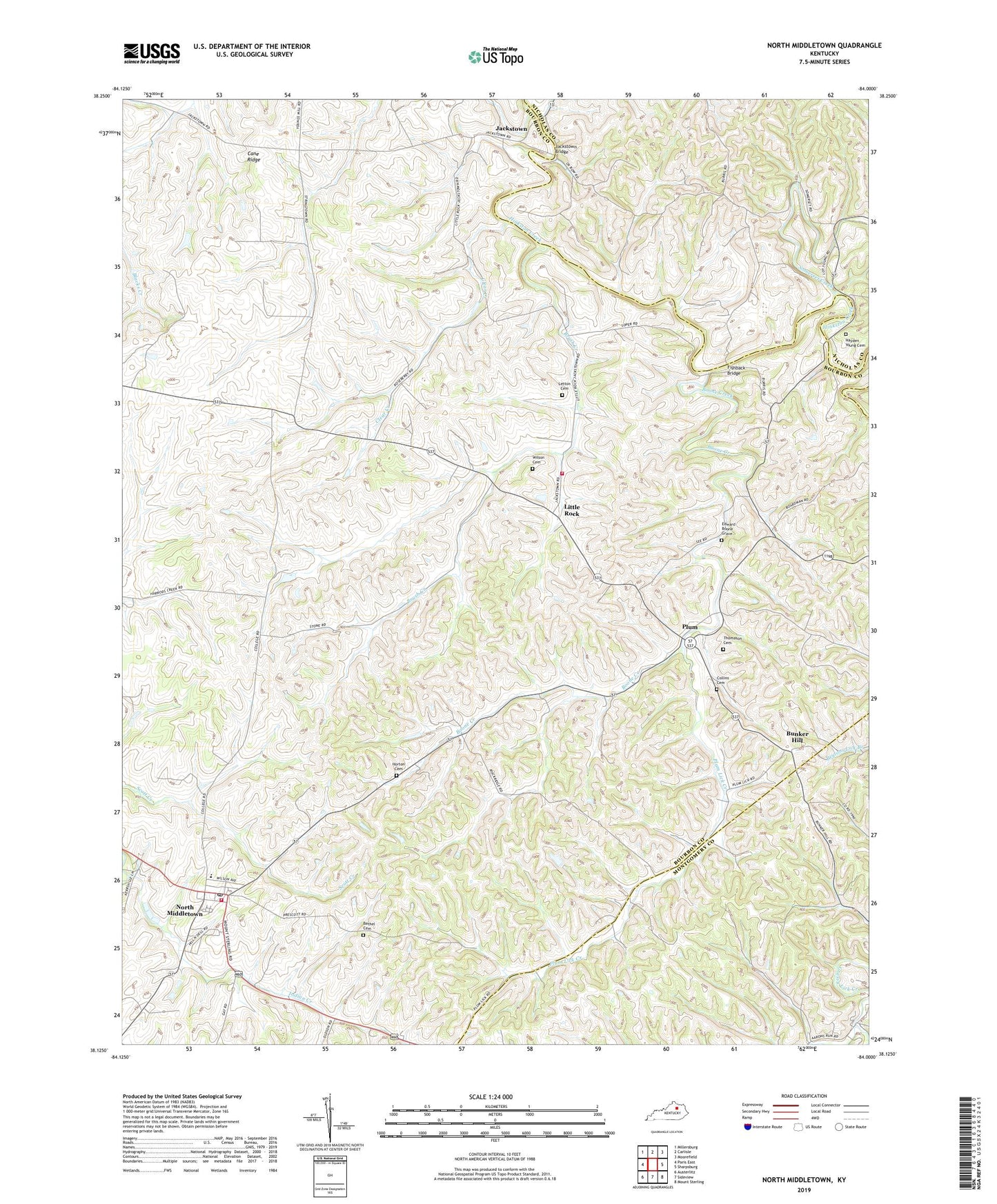
2022 topographic map quadrangle North Middletown in the state of Kentucky. Scale: 1:24000. Based on the newly updated USGS 7.5' US Topo map series, this map is in the following counties: Bourbon, Nicholas, Montgomery. The map contains contour data, water features, and other items you are used to seeing on USGS maps, but also has updated roads and other features. This is the next generation of topographic maps. Printed on high-quality waterproof paper with UV fade-resistant inks.
Quads adjacent to this one:
West: Paris East
Northwest: Millersburg
North: Carlisle
Northeast: Moorefield
East: Sharpsburg
Southeast: Mount Sterling
South: Sideview
Southwest: Austerlitz
This map covers the same area as the classic USGS quad with code o38084b1.
Contains the following named places: Aarons Run, Aarons Run Post Office, Adeline, Bethel Cemetery, Boone Creek, Brush Creek, Bunker Hill, Cane Ridge, Cane Ridge Meetinghouse, City of North Middletown, Clear Creek, Colletts, Collins Cemetery, Edward Boone Grave, Fishback Bridge, Hayden Young Cemetery, Horton Cemetery, Indian Creek, Jackstown, Jackstown Bridge, Letton Cemetery, Little Rock, Little Rock Volunteer Fire Department, North Middletown, North Middletown Division, North Middletown Fire Department, North Middletown Post Office, Plum, Plum Lick, Plum Lick Creek, Somerset Creek, Taylors Creek, Thomason Cemetery, Trinity School, Wilson Cemetery