MyTopo
Paris East Kentucky US Topo Map
Couldn't load pickup availability
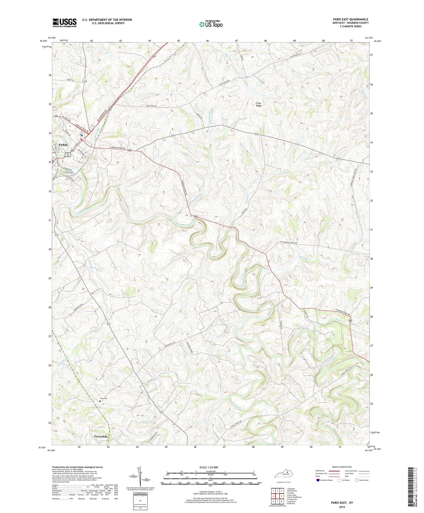
2022 topographic map quadrangle Paris East in the state of Kentucky. Scale: 1:24000. Based on the newly updated USGS 7.5' US Topo map series, this map is in the following counties: Bourbon. The map contains contour data, water features, and other items you are used to seeing on USGS maps, but also has updated roads and other features. This is the next generation of topographic maps. Printed on high-quality waterproof paper with UV fade-resistant inks.
Quads adjacent to this one:
West: Paris West
Northwest: Shawhan
North: Millersburg
Northeast: Carlisle
East: North Middletown
Southeast: Sideview
South: Austerlitz
Southwest: Clintonville
This map covers the same area as the classic USGS quad with code o38084b2.
Contains the following named places: Bourbon Community Hospital, Bourbon County, Bourbon County Fire Rescue Department, Bourbon County Sheriff's Office, Clay Cemetery, Escondida, Green Creek, Harrods Creek, Houston Creek, Kennedy Creek, McDowells Run, Mitchells Run, Rogers Creek, Scott Creek, Spears Mill Church, Strodes Creek, WRPZ-AM (Paris), ZIP Code: 40361