MyTopo
Millersburg Kentucky US Topo Map
Couldn't load pickup availability
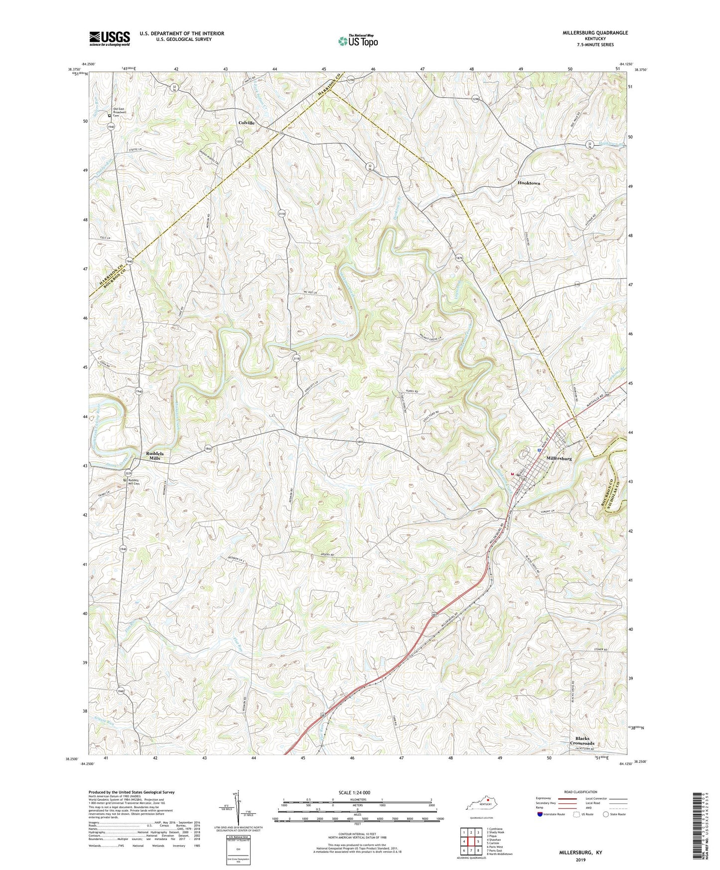
2022 topographic map quadrangle Millersburg in the state of Kentucky. Scale: 1:24000. Based on the newly updated USGS 7.5' US Topo map series, this map is in the following counties: Bourbon, Nicholas, Harrison. The map contains contour data, water features, and other items you are used to seeing on USGS maps, but also has updated roads and other features. This is the next generation of topographic maps. Printed on high-quality waterproof paper with UV fade-resistant inks.
Quads adjacent to this one:
West: Shawhan
Northwest: Cynthiana
North: Shady Nook
Northeast: Piqua
East: Carlisle
Southeast: North Middletown
South: Paris East
Southwest: Paris West
This map covers the same area as the classic USGS quad with code o38084c2.
Contains the following named places: Big Brushy Creek, Blacks Crossroads, City of Millersburg, Colville, Colville Post Office, Herrington Church, Hinkston Creek, Hooktown, Hooktown Branch, Hooktown Post Office, Indian Creek Church, Irish Railroad Station, Laysons Branch, Millersburg, Millersburg Division, Millersburg Fire and Rescue, Millersburg Military Academy, Millersburg Police Department, Millersburg Post Office, Old East Broadwell Cemetery, Pleasant Hill, Pleasant Hill Farm, Ruddels Mill Cemetery, Ruddels Mills, Stoner Creek, Walnut Grove, ZIP Code: 40348