MyTopo
Drakesboro Kentucky US Topo Map
Couldn't load pickup availability
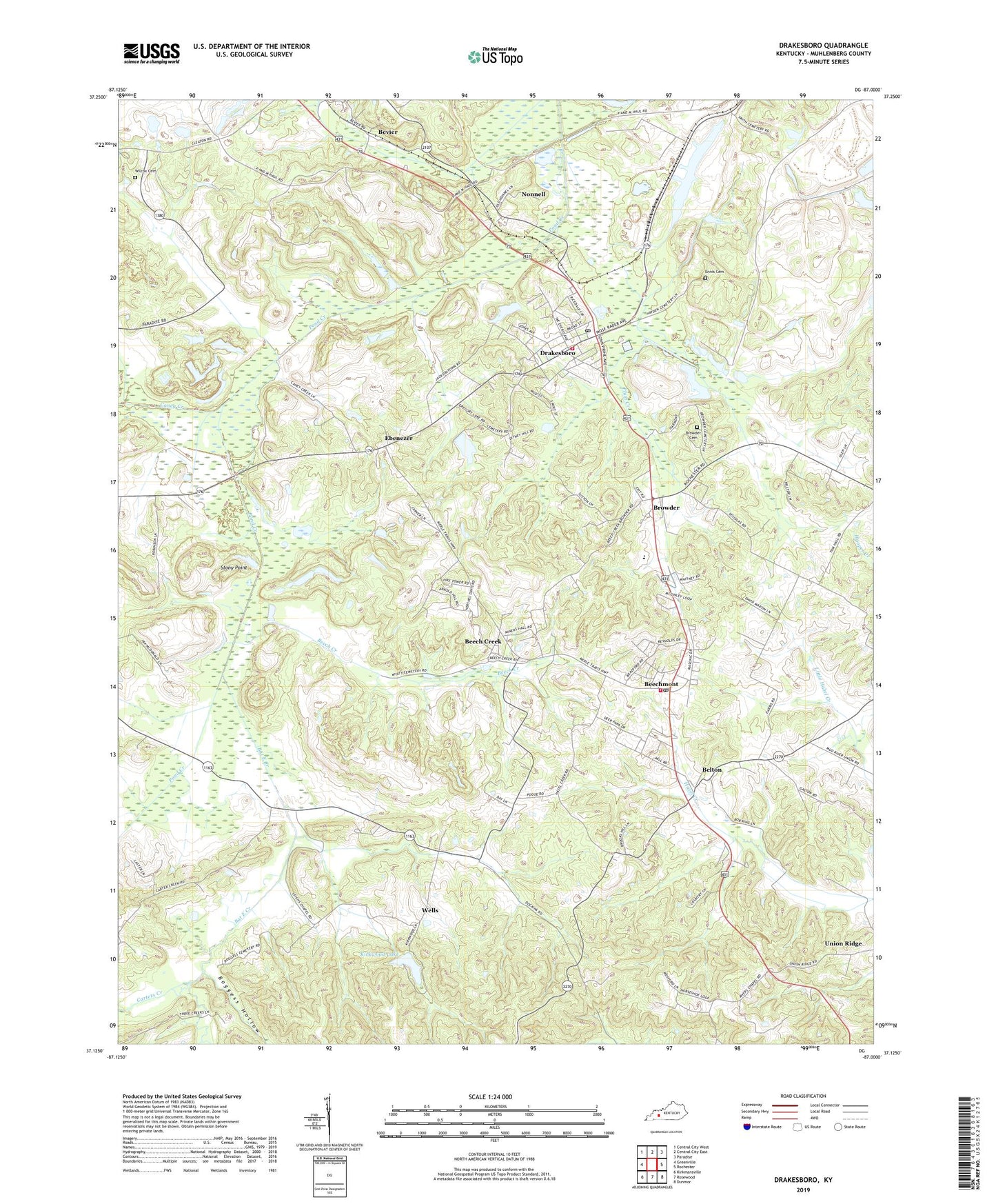
2022 topographic map quadrangle Drakesboro in the state of Kentucky. Scale: 1:24000. Based on the newly updated USGS 7.5' US Topo map series, this map is in the following counties: Muhlenberg. The map contains contour data, water features, and other items you are used to seeing on USGS maps, but also has updated roads and other features. This is the next generation of topographic maps. Printed on high-quality waterproof paper with UV fade-resistant inks.
Quads adjacent to this one:
West: Greenville
Northwest: Central City West
North: Central City East
Northeast: Paradise
East: Rochester
Southeast: Dunmor
South: Rosewood
Southwest: Kirkmansville
This map covers the same area as the classic USGS quad with code o37087b1.
Contains the following named places: Bat East Creek, Beech Creek, Beechmont, Beechmont Census Designated Place, Beechmont Post Office, Beechmont Volunteer Fire Department, Belton, Bevier, Boggess Hollow, Browder, Browder Cemetery, Caney Creek, Carters Creek, City of Drakesboro, Drakesboro, Drakesboro Division, Drakesboro Post Office, Drakesboro Volunteer Fire Department, Ebenezer, Elk Valley, Ennis Cemetery, Hazel Creek Church, Kirkwood Lake, Leighs, Liberty Hill, Nonnell, Peanut, Plum Creek, Stony Point, Sunrise, Union Ridge, Wells, Wilcox Cemetery, WKYA-FM (Central City), ZIP Codes: 42321, 42323, 42324, 42326