MyTopo
Rochester Kentucky US Topo Map
Couldn't load pickup availability
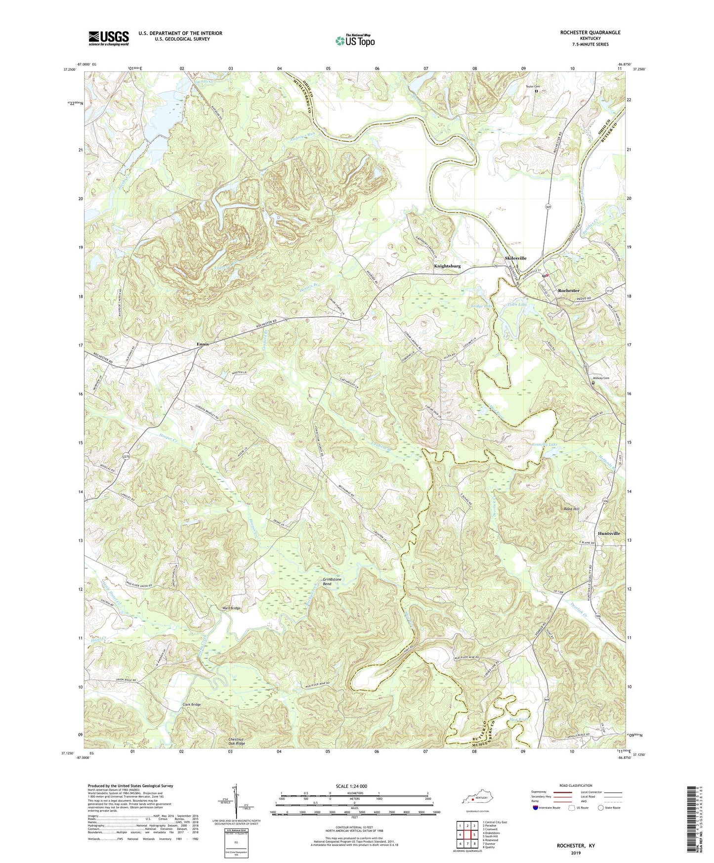
2022 topographic map quadrangle Rochester in the state of Kentucky. Scale: 1:24000. Based on the newly updated USGS 7.5' US Topo map series, this map is in the following counties: Muhlenberg, Butler, Ohio. The map contains contour data, water features, and other items you are used to seeing on USGS maps, but also has updated roads and other features. This is the next generation of topographic maps. Printed on high-quality waterproof paper with UV fade-resistant inks.
Quads adjacent to this one:
West: Drakesboro
Northwest: Central City East
North: Paradise
Northeast: Cromwell
East: South Hill
Southeast: Quality
South: Dunmor
Southwest: Rosewood
This map covers the same area as the classic USGS quad with code o37086b8.
Contains the following named places: Andrews Run, Bridge Lake, Canfield Branch, City of Rochester, Clark Bridge, Connelly Lake, Daniels Branch, Davenport Landing, Deerlick Creek, Ennis, Forest Grove, Forest Grove Church, Forest Oak, Forest Oak School, Grindstone Bend, Hazel Creek, Hooper Creek, Huntsville, Knightsburg, Little Hazel Creek, Lock Number 3, McPhersons, Meffords Branch, Midway Cemetery, Mud River, Mud River Mine School, Mud River Union, Mud River Union School, Panther Creek, Penrod Division, Reed Hill, Riverside, Rochester, Rochester Post Office, Rochester Volunteer Fire Department, Rocky Creek, Skilesville, Spur Creek, Taylor Cemetery, Town Lake, Union Chapel General Baptist Church, Union School, Ward Bridge, ZIP Code: 42337