MyTopo
Bristow Kentucky US Topo Map
Couldn't load pickup availability
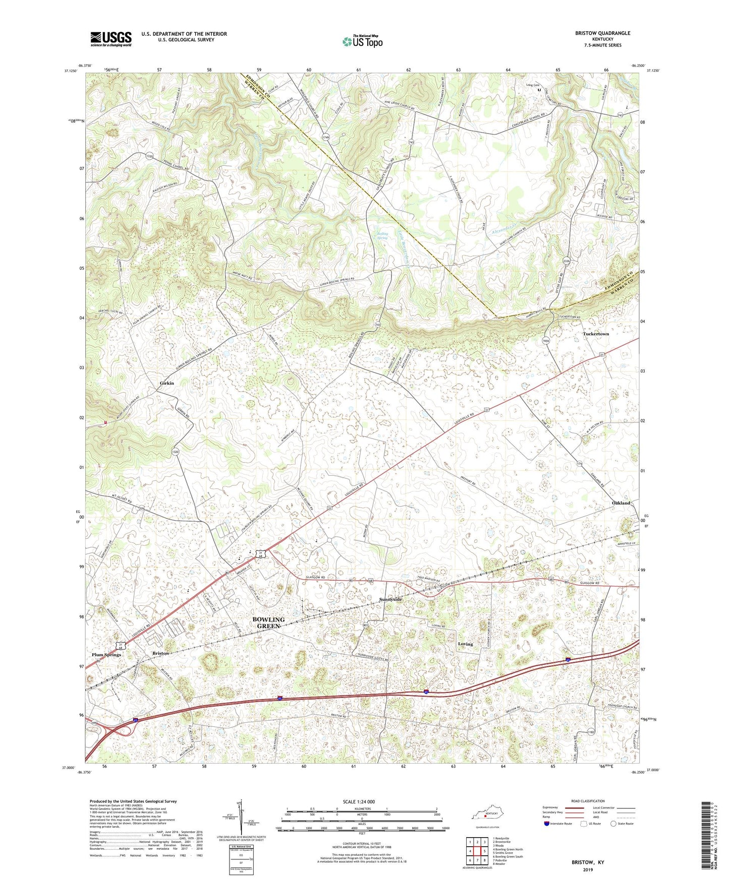
2022 topographic map quadrangle Bristow in the state of Kentucky. Scale: 1:24000. Based on the newly updated USGS 7.5' US Topo map series, this map is in the following counties: Warren, Edmonson. The map contains contour data, water features, and other items you are used to seeing on USGS maps, but also has updated roads and other features. This is the next generation of topographic maps. Printed on high-quality waterproof paper with UV fade-resistant inks.
Quads adjacent to this one:
West: Bowling Green North
Northwest: Reedyville
North: Brownsville
Northeast: Rhoda
East: Smiths Grove
Southeast: Meador
South: Polkville
Southwest: Bowling Green South
This map covers the same area as the classic USGS quad with code o37086a3.
Contains the following named places: Boiling Spring, Bristow, Bristow Church, Bristow Elementary School, Chalybeate School, City of Oakland, Cowles Chapel, Fairview Church, Friendship Church, Girkin, Jackson Grove Church, Long Cemetery, Loving, Old Stagecoach Stop Historical Marker, Otter Gap Church, Penns Chapel, Pine Grove Church, Plum Springs Church, Richardsville Volunteer Fire Department Station 2, Sand Hill-Girkin Division, Shady Land Church, Smithland, Sunnyside, Tuckertown, Union Church, WBLG-FM (Smiths Grove), WDNS-FM (Bowling Green)