MyTopo
Sharon Grove Kentucky US Topo Map
Couldn't load pickup availability
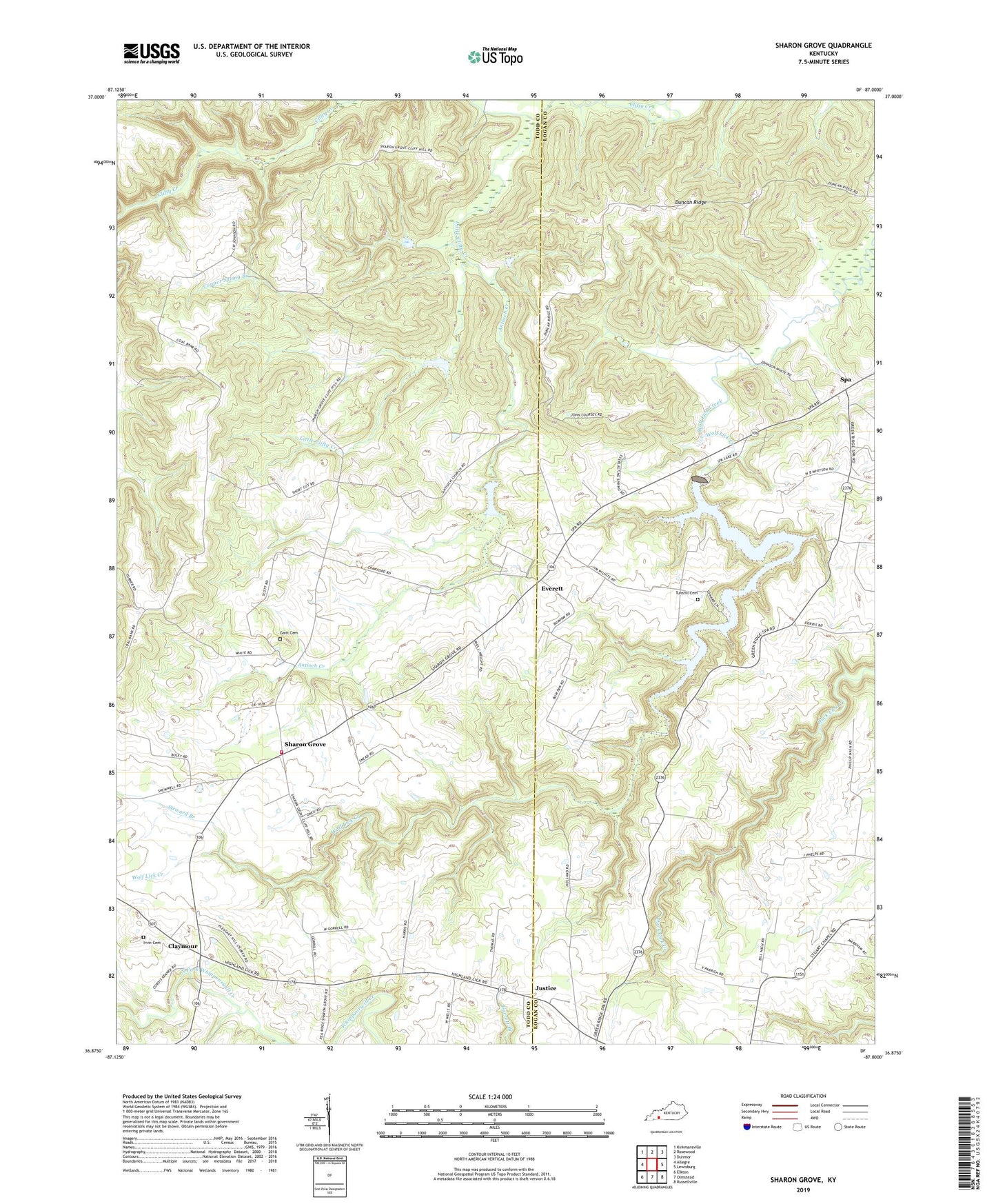
2022 topographic map quadrangle Sharon Grove in the state of Kentucky. Scale: 1:24000. Based on the newly updated USGS 7.5' US Topo map series, this map is in the following counties: Logan, Todd. The map contains contour data, water features, and other items you are used to seeing on USGS maps, but also has updated roads and other features. This is the next generation of topographic maps. Printed on high-quality waterproof paper with UV fade-resistant inks.
Quads adjacent to this one:
West: Allegre
Northwest: Kirkmansville
North: Rosewood
Northeast: Dunmor
East: Lewisburg
Southeast: Russellville
South: Olmstead
Southwest: Elkton
This map covers the same area as the classic USGS quad with code o36087h1.
Contains the following named places: Antioch Church, Antioch Creek, Ashbury, Claymour, Copper Spring Branch, Duncan Ridge, Duncan Ridge School, Everett, Gant Cemetery, Green Ridge, Hickory Ridge School, Irvin Cemetery, Justice, Little Clifty Creek, Mineral Spring Church, Mineral Spring School, Mount Sharon Methodist Church, Mount Vernon Church, Pleasant Hill Church, Sharon Grove, Sharon Grove Volunteer Fire Department, Spa, Spa Lake, Steward Branch, Tunstill Cemetery, Tunstill School, ZIP Code: 42280