MyTopo
Upton Kentucky US Topo Map
Couldn't load pickup availability
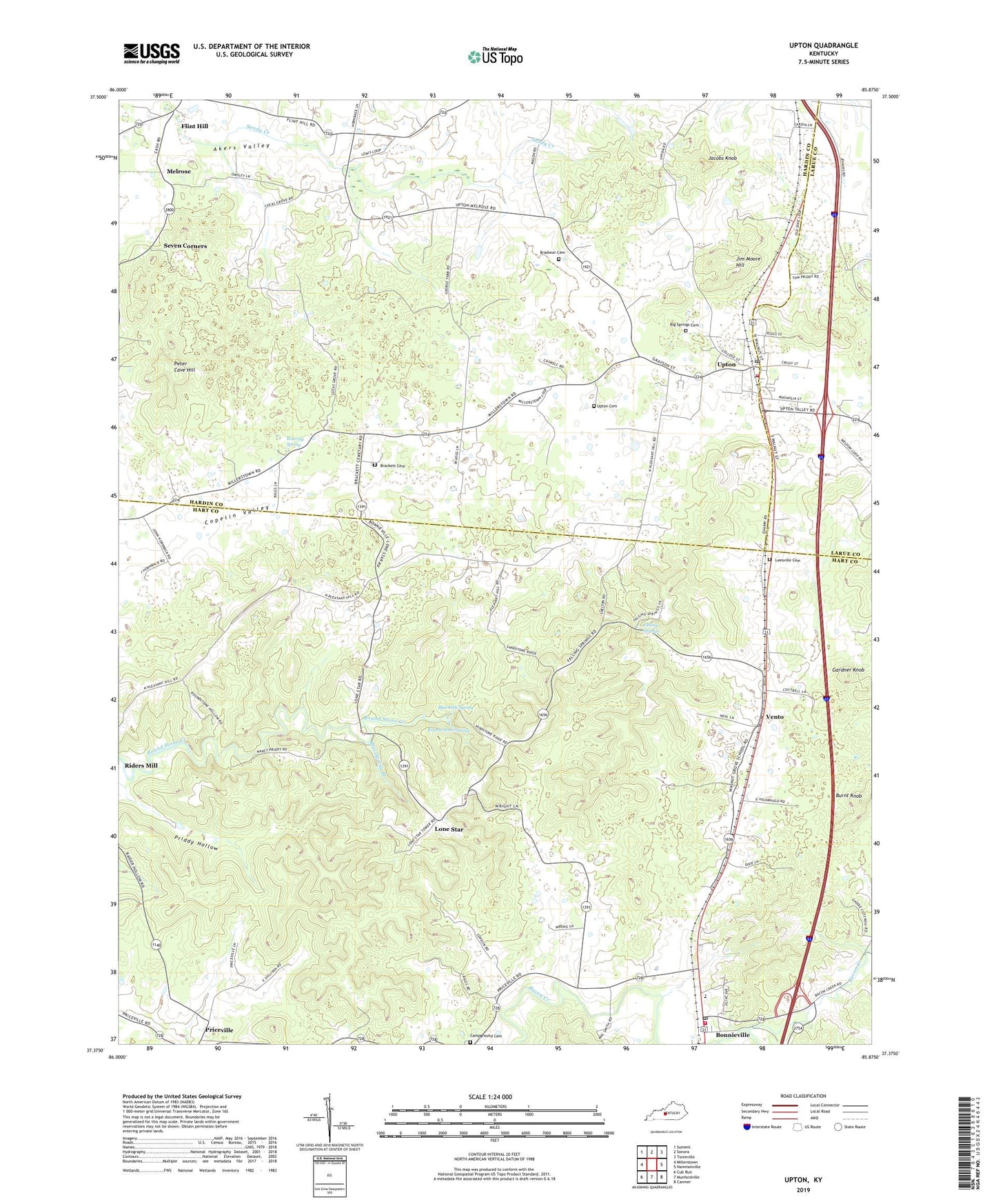
2022 topographic map quadrangle Upton in the state of Kentucky. Scale: 1:24000. Based on the newly updated USGS 7.5' US Topo map series, this map is in the following counties: Hart, Hardin, Larue. The map contains contour data, water features, and other items you are used to seeing on USGS maps, but also has updated roads and other features. This is the next generation of topographic maps. Printed on high-quality waterproof paper with UV fade-resistant inks.
Quads adjacent to this one:
West: Millerstown
Northwest: Summit
North: Sonora
Northeast: Tonieville
East: Hammonville
Southeast: Canmer
South: Munfordville
Southwest: Cub Run
This map covers the same area as the classic USGS quad with code o37085d8.
Contains the following named places: Bethel Church, Big Springs Cemetery, Blue Hole Spring, Blue Spring Branch, Bonnieville, Bonnieville Division, Bonnieville Post Office, Bonnieville Volunteer Fire Department, Brackett Cemetery, Brashear Cemetery, Burnt Knob, Camp Ground Cemetery, City of Bonnieville, City of Upton, Falling Springs, Falling Springs United Baptist Church, Flint Hill, Gardner Knob, Indian Ambush Historical Marker, Jacobs Knob, Jim Moore Hill, Leesville Cemetery, Lone Star, Lucas Grove Church, Melrose, Peter Cave Hill, Pleasant Hill Church, Priddy Hollow, Riders Mill, Roaring Spring, Round Stone Spring, Sandy Creek, Seven Corners, Stoney Point Church, Upton, Upton Cemetery, Upton Fire Department, Upton Post Office, Vento, Zion Church, ZIP Codes: 42713, 42784