MyTopo
Park Kentucky US Topo Map
Couldn't load pickup availability
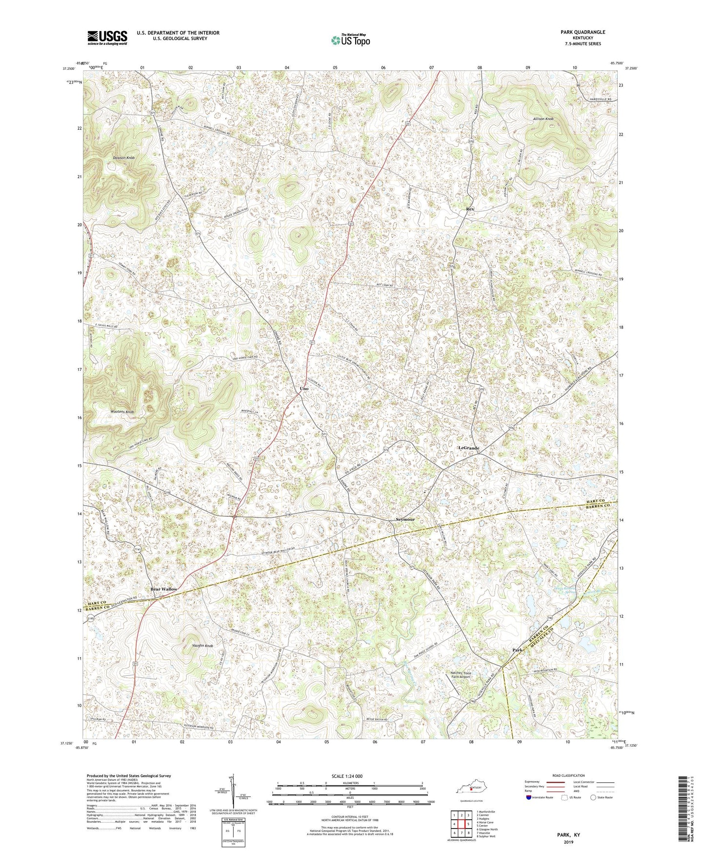
2022 topographic map quadrangle Park in the state of Kentucky. Scale: 1:24000. Based on the newly updated USGS 7.5' US Topo map series, this map is in the following counties: Hart, Barren, Metcalfe. The map contains contour data, water features, and other items you are used to seeing on USGS maps, but also has updated roads and other features. This is the next generation of topographic maps. Printed on high-quality waterproof paper with UV fade-resistant inks.
Quads adjacent to this one:
West: Horse Cave
Northwest: Munfordville
North: Canmer
Northeast: Hudgins
East: Center
Southeast: Sulphur Well
South: Hiseville
Southwest: Glasgow North
This map covers the same area as the classic USGS quad with code o37085b7.
Contains the following named places: Allison Knob, Bear Wallow, Bearwallow Church of Christ, Blue Spring Creek, Bunnell Crossing, C B Hutcherson Historical Marker, Cosby Church, Dawson Knob, Drury Roberts Spring, Fisher Spring, Green Chapel, Hardyville Division, Knob Church, LeGrande, Lemon Branch, Little Blue Spring Church, Lonoke Church, Natchez Trace Farm Airport, Oak Ridge School, Park, Rex, Rock Springs Church, Seymour, Uno, Vaughn Knob, Wigwam, Wootens Knob