MyTopo
Hiseville Kentucky US Topo Map
Couldn't load pickup availability
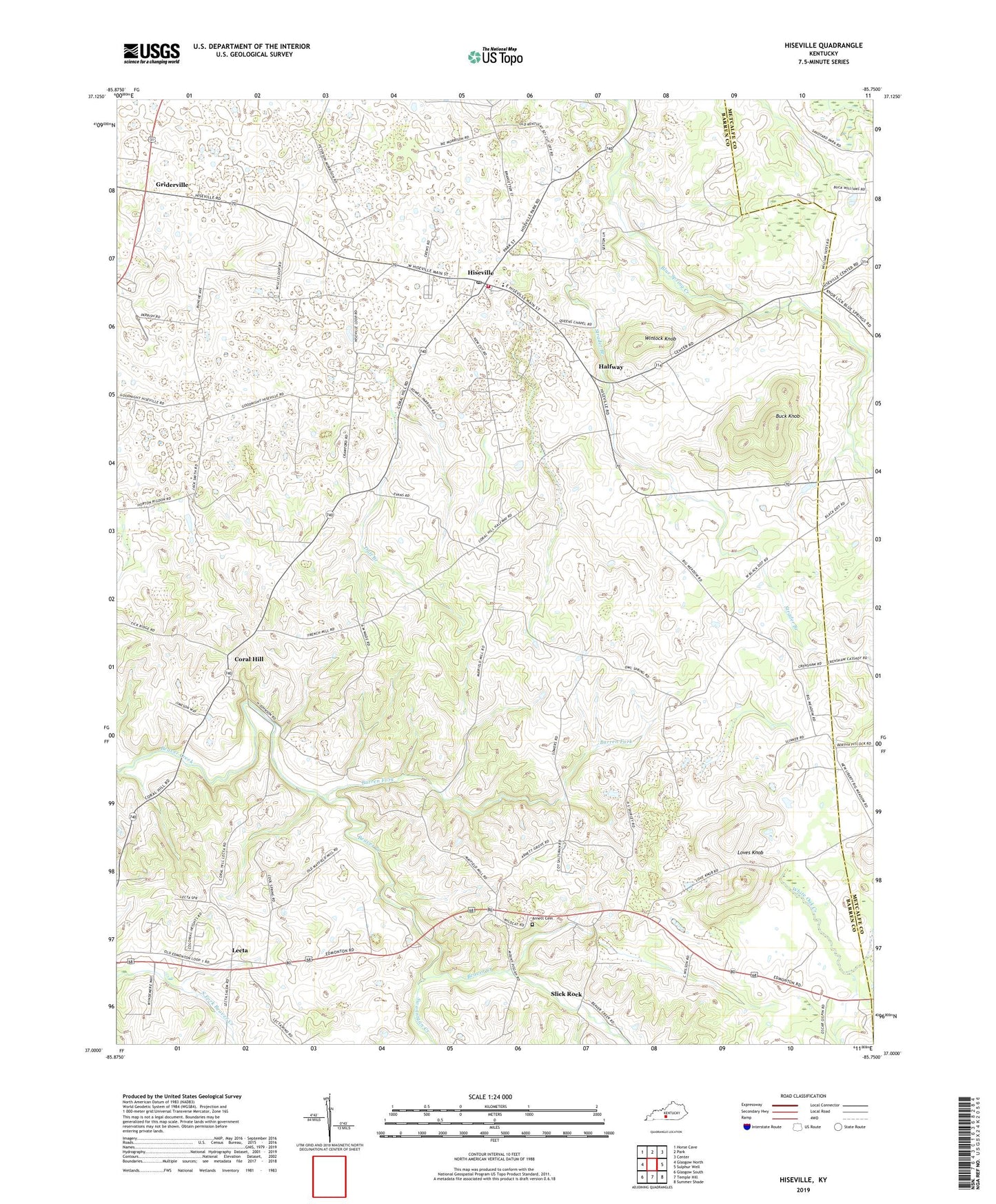
2022 topographic map quadrangle Hiseville in the state of Kentucky. Scale: 1:24000. Based on the newly updated USGS 7.5' US Topo map series, this map is in the following counties: Barren, Metcalfe. The map contains contour data, water features, and other items you are used to seeing on USGS maps, but also has updated roads and other features. This is the next generation of topographic maps. Printed on high-quality waterproof paper with UV fade-resistant inks.
Quads adjacent to this one:
West: Glasgow North
Northwest: Horse Cave
North: Park
Northeast: Center
East: Sulphur Well
Southeast: Summer Shade
South: Temple Hill
Southwest: Glasgow South
This map covers the same area as the classic USGS quad with code o37085a7.
Contains the following named places: Arnett Cemetery, Barren Fork, Big Meadow Church, Blue Spring, Blue Spring Church, Buck Knob, City of Hiseville, Coral Hill, Duff Branch, Griderville, Halfway, Hickory Grove Church, Hiseville, Hiseville Census Designated Place, Hiseville Division, Hiseville Fire Department, Hiseville Post Office, Lecta, Loves Knob, Mount Pisgah Church, Neals Chapel, Pleasant Union Church, Queens Chapel, Slick Rock, Strader Branch, Swannigan Creek, White Oak Creek, Winlock Knob