MyTopo
Tiptop Kentucky US Topo Map
Couldn't load pickup availability
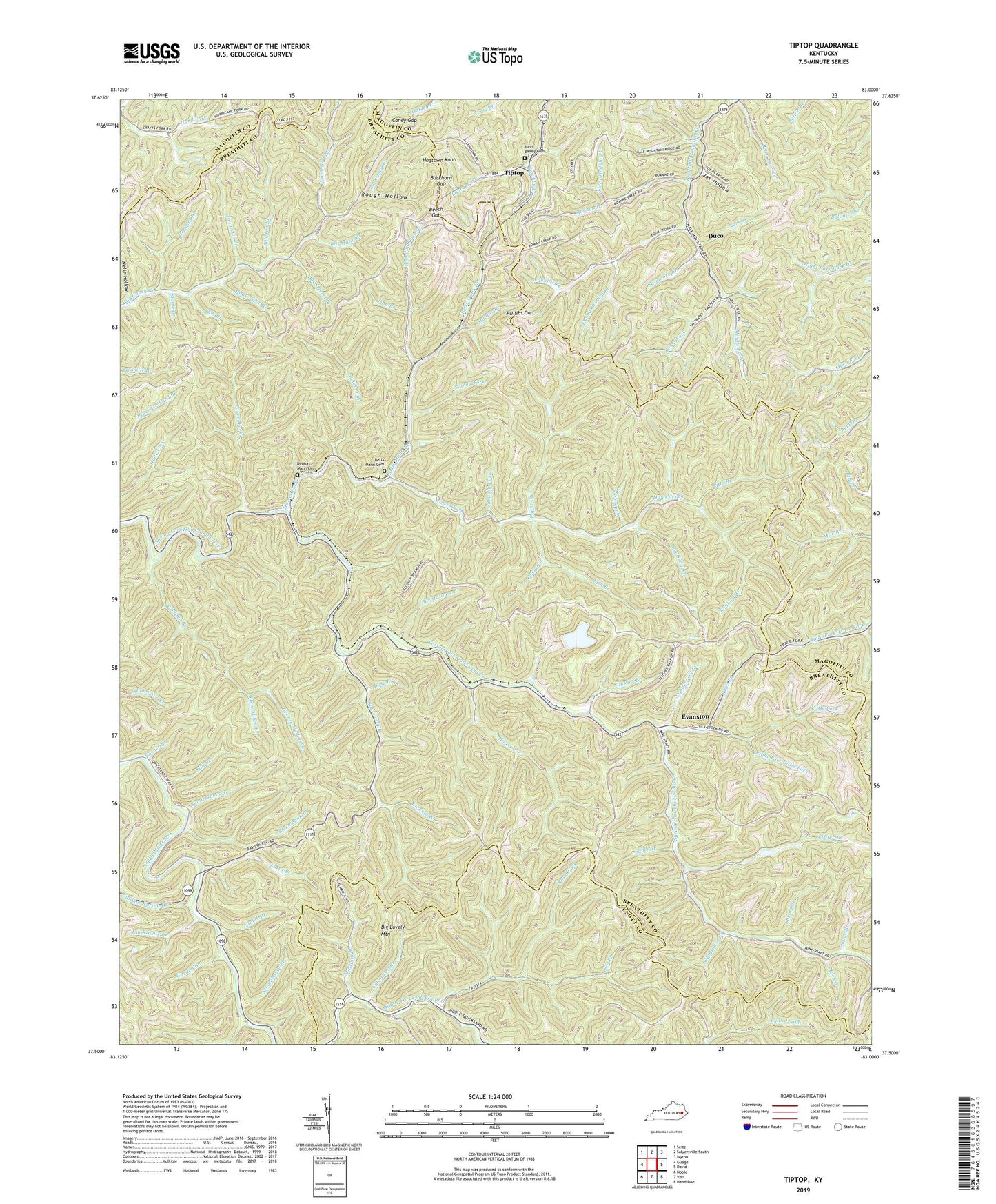
2022 topographic map quadrangle Tiptop in the state of Kentucky. Scale: 1:24000. Based on the newly updated USGS 7.5' US Topo map series, this map is in the following counties: Breathitt, Magoffin, Knott. The map contains contour data, water features, and other items you are used to seeing on USGS maps, but also has updated roads and other features. This is the next generation of topographic maps. Printed on high-quality waterproof paper with UV fade-resistant inks.
Quads adjacent to this one:
West: Guage
Northwest: Seitz
North: Salyersville South
Northeast: Ivyton
East: David
Southeast: Handshoe
South: Vest
Southwest: Noble
This map covers the same area as the classic USGS quad with code o37083e1.
Contains the following named places: Ball Jim Branch, Barnett Branch, Beck Branch, Beech Gap, Benton Mann Cemetery, Betts Mann Branch, Betts Mann Cemetery, Big Branch, Big Caney School, Big Cudge Branch, Big Laurel Branch, Big Lovely Branch, Big Lovely Mountain, Bill Mann Branch, Boardinghouse Branch, Bob Branch, Brushy Fork, Buckhorn Gap, Burnt House Branch, Cabin Log Branch, Came Branch, Caney Gap, Chick Fork, Coles Fork, Davis Branch, Decoy Post Office, Duco, Duco School, Elvania Branch, Equal Fork, Evanston, Faith Mount Church, Flora Holliday Branch, Garden Branch, George Mullins Branch, Gouge Branch, Hawes Fork, Hawes Fork School, Hogtown Knob, Horsemill Branch, Hoskins Fork, House Seat Branch, Hughes Creek, Jim Ritchie Branch, Joe Hollow, Joe Push Branch, John Bailey Cemetery, Kates Branch, Laurel Fork, Line Branch, Lish Branch, Little Fork, Mandy Fork, Middle Fork, Mill Branch, Millstone Branch, Mud Lick Branch, Mullins Branch, Mullins Gap, Nelse Hollow, Nerve Fork, Old House Branch, Oliver Branch, Oney Branch, Orchard Branch, Pitts Branch, Polly Miller Branch, Poplar Branch, Prater Branch, Rich Branch, Right Fork Little Fork, Road Branch, Road Fork, Robbins Branch, Rose Branch, Rough Hollow, Rowan Branch, Sable Branch, Sam Branch, Sand Lick Branch, Schoolhouse Branch, Slusher Branch, Spring Branch, Spring Fork School, Stable Branch, Steep Bank Branch, Sugar Camp Branch, Sulphur Spring Branch, Sycamore Branch, Thomas Conley Branch, Tiptop, Twin Lick Branch, Vanderpool Branch, Wireman Fork, Wolfpen Branch, Wolfspur Branch