MyTopo
Bee Bayou Louisiana US Topo Map
Couldn't load pickup availability
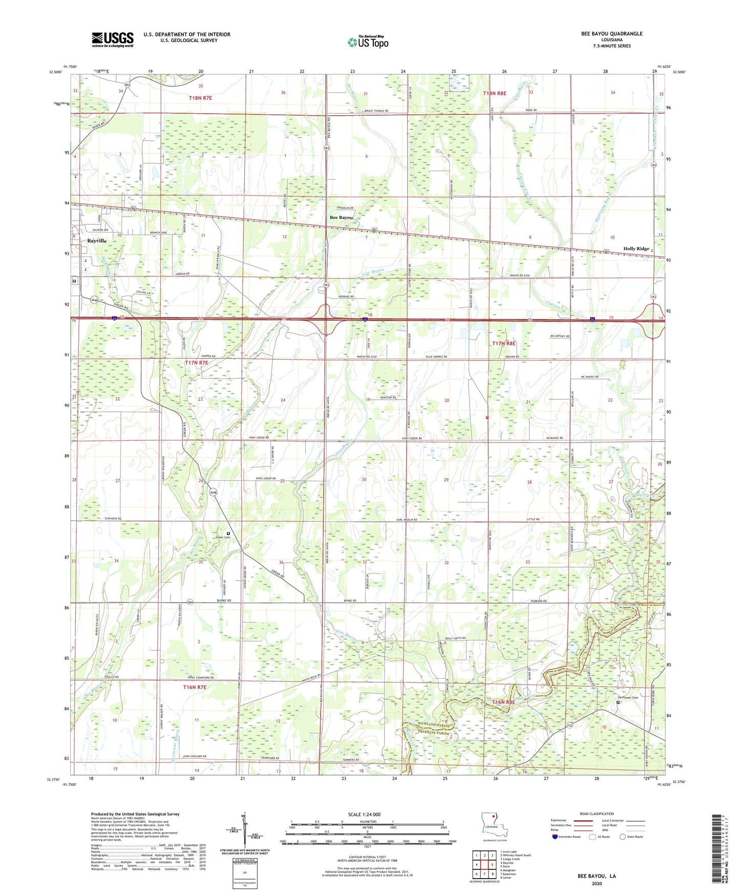
2024 topographic map quadrangle Bee Bayou in the state of Louisiana. Scale: 1:24000. Based on the newly updated USGS 7.5' US Topo map series, this map is in the following counties: Richland, Franklin. The map contains contour data, water features, and other items you are used to seeing on USGS maps, but also has updated roads and other features. This is the next generation of topographic maps. Printed on high-quality waterproof paper with UV fade-resistant inks.
Quads adjacent to this one:
West: Rayville
Northwest: Irwin Lake
North: Whitney Island South
Northeast: Congo Creek
East: Dunn
Southeast: Lamar
South: Baskinton
Southwest: Mangham
This map covers the same area as the classic USGS quad with code o32091d6.
Contains the following named places: Bee Bayou, Big Creek Gas Field, Burns Bayou, Cow Bayou, Cypress Creek, Dehlco Oil Field, East Fork Creek, Grace Church, Greer Cemetery, Holly Ridge, Holly Ridge Church, Holly Ridge Elementary School, Hunters Chapel, Hurricane Bayou, KTJC-FM (Rayville), Mixon Church, Parish Governing Authority District 4, Parish Governing Authority District 5, Rayville High School, Rayville Junior High School, Richardson Medical Center, Riverfield Academy School, Saint Peter Church, Squires Heliport, Sunflower Cemetery, Ward Two, West Fork Creek, Zebedee Church