MyTopo
Calhoun Louisiana US Topo Map
Couldn't load pickup availability
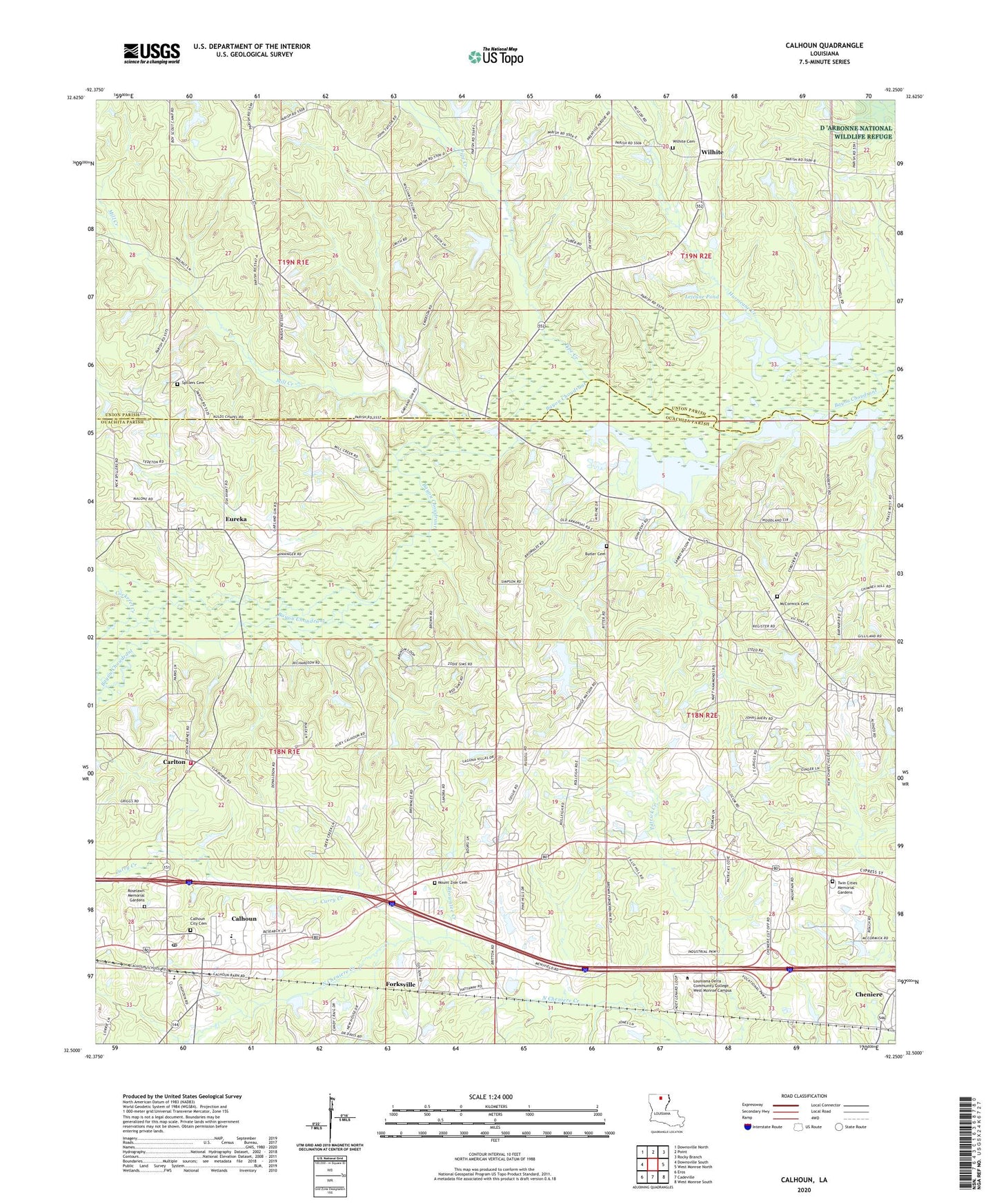
2024 topographic map quadrangle Calhoun in the state of Louisiana. Scale: 1:24000. Based on the newly updated USGS 7.5' US Topo map series, this map is in the following counties: Ouachita, Union. The map contains contour data, water features, and other items you are used to seeing on USGS maps, but also has updated roads and other features. This is the next generation of topographic maps. Printed on high-quality waterproof paper with UV fade-resistant inks.
Quads adjacent to this one:
West: Downsville South
Northwest: Downsville North
North: Point
Northeast: Rocky Branch
East: West Monroe North
Southeast: West Monroe South
South: Cadeville
Southwest: Eros
This map covers the same area as the classic USGS quad with code o32092e3.
Contains the following named places: Aulds Chapel, Bluff Springs Church, Browntee Creek, Butler Cemetery, Calhoun, Calhoun Census Designated Place, Calhoun Elementary School, Calhoun Gas and Oil Field, Calhoun Middle School, Calhoun Post Office, Camp Ch-Yo-Ca, Camp Road Church, Carlton, Carlton Church, Carlton Gas Field, Center School, Cockerel Creek, Curry Creek, Drew Gas Field, Eureka, Eureka School, Forksville, Jerusalem Baptist Church, Lejeune Pond, Lejeune Pond Dam, Liberty Baptist Church, Louisiana Delta Community College West Monroe Campus, McCormick Cemetery, Mill Creek, Mount Zion Cemetery, New Chapel Hill Baptist Church, North Louisiana Experimental Station, Ouachita Parish Fire Protection District 1 Station 16, Ouachita Parish Fire Protection District 1 Station 8, Ouachita Valley Council Scout Reservation, Pine Hills Golf Club, Pipe Creek, Pleasant Grove Church, Roselawn Memorial Gardens, Saint Francis Church, Spillers Cemetery, Spring Hill Church, Trace Estates, Twin Cities Memorial Gardens, United Pentecostal Church, Walnut Lane, Ward Six, West Ouachita Industrial Park, Wilhite, Wilhite Cemetery, ZIP Code: 71225