MyTopo
Point Louisiana US Topo Map
Couldn't load pickup availability
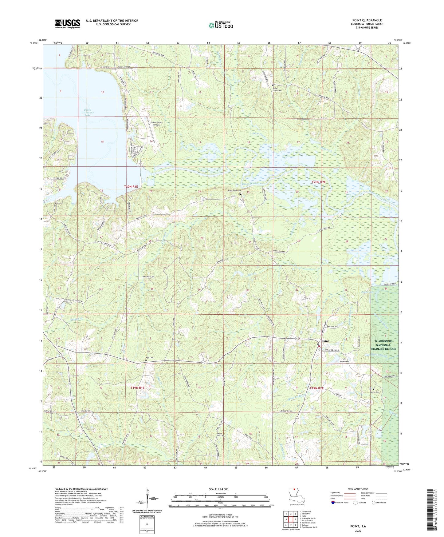
2024 topographic map quadrangle Point in the state of Louisiana. Scale: 1:24000. Based on the newly updated USGS 7.5' US Topo map series, this map is in the following counties: Union. The map contains contour data, water features, and other items you are used to seeing on USGS maps, but also has updated roads and other features. This is the next generation of topographic maps. Printed on high-quality waterproof paper with UV fade-resistant inks.
Quads adjacent to this one:
West: Downsville North
Northwest: Farmerville
North: De Loutre
Northeast: Haile
East: Rocky Branch
Southeast: West Monroe North
South: Calhoun
Southwest: Downsville South
This map covers the same area as the classic USGS quad with code o32092f3.
Contains the following named places: Acree Cemetery, Antioch School, Bayles Pond Dam, Bayou Darbonne Dam, Briny Bridge Creek, Carter Cemetery, Downsville Gas Field, Francis Creek, Francis Creek Lake, Francis Creek Lake Dam, Horse Pen Creek, Jones Lake, King Cemetery, Lick Creek, Morse Hill Cemetery, Moselys Bluff, Mount Ararat Church, Parish Governing Authority District 5, Point, Point Assembly of God Church, Point Wilhite Fire Department, Providence Church, Rogers Creek, Ruggs Bluff Cemetery, Shady Grove Cemetery, Shady Grove Church, Terrills, Tiger Creek, Tucker Creek, Union Parish Airport, Ward Five, ZIP Code: 71234