MyTopo
Calvin Louisiana US Topo Map
Couldn't load pickup availability
Also explore the Calvin Forest Service Topo of this same quad for updated USFS data
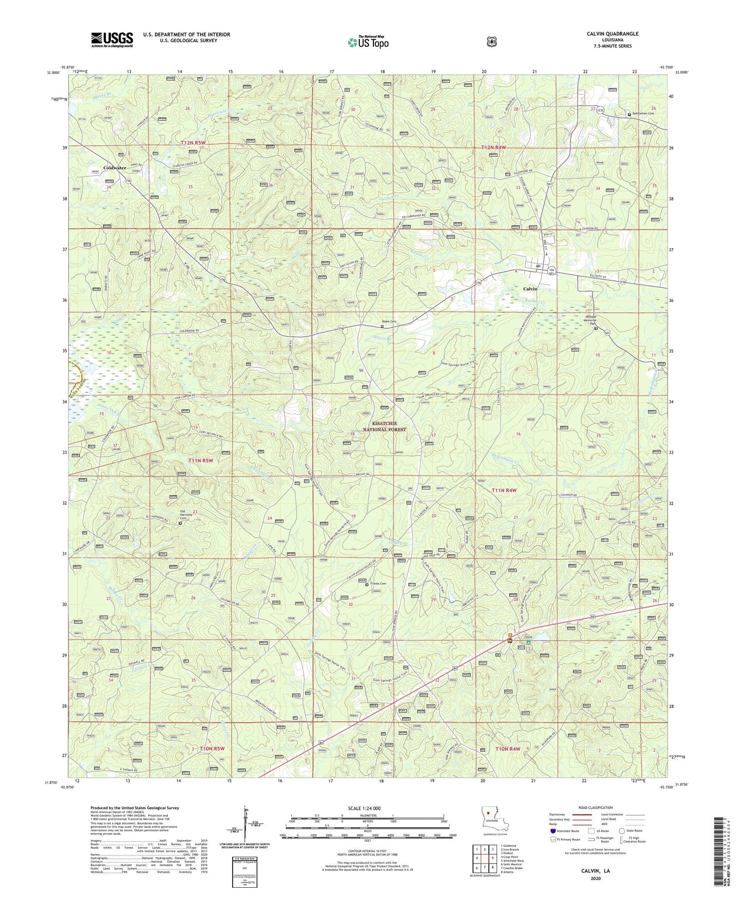
2024 topographic map quadrangle Calvin in the state of Louisiana. Scale: 1:24000. Based on the newly updated USGS 7.5' US Topo map series, this map is in the following counties: Winn, Natchitoches. The map contains contour data, water features, and other items you are used to seeing on USGS maps, but also has updated roads and other features. This is the next generation of topographic maps. Printed on high-quality waterproof paper with UV fade-resistant inks.
Quads adjacent to this one:
West: Coup Point
Northwest: Goldonna
North: Iron Branch
Northeast: Dodson
East: Winnfield West
Southeast: Atlanta
South: Coochie Brake
Southwest: Saint Maurice
This map covers the same area as the classic USGS quad with code o31092h7.
Contains the following named places: Bethlehem Cemetery, Bethlehem Church, Blake Cemetery, Calvin, Calvin High School, Coldwater, Franks Cemetery, Garfish Creek, Gum Springs Campground and Picnic Area, Gum Springs Lookout Tower, Gum Springs Work Center, McDade Memorial Park, Milam Branch, Mill Creek, Old Harmony Cemetery, Parish Governing Authority District 3, Saline Grove Church, Sanders Chapel, Sanders Church, Village of Calvin, Ward Eight, White Oak Creek, ZIP Code: 71410