MyTopo
Atlanta Louisiana US Topo Map
Couldn't load pickup availability
Also explore the Atlanta Forest Service Topo of this same quad for updated USFS data
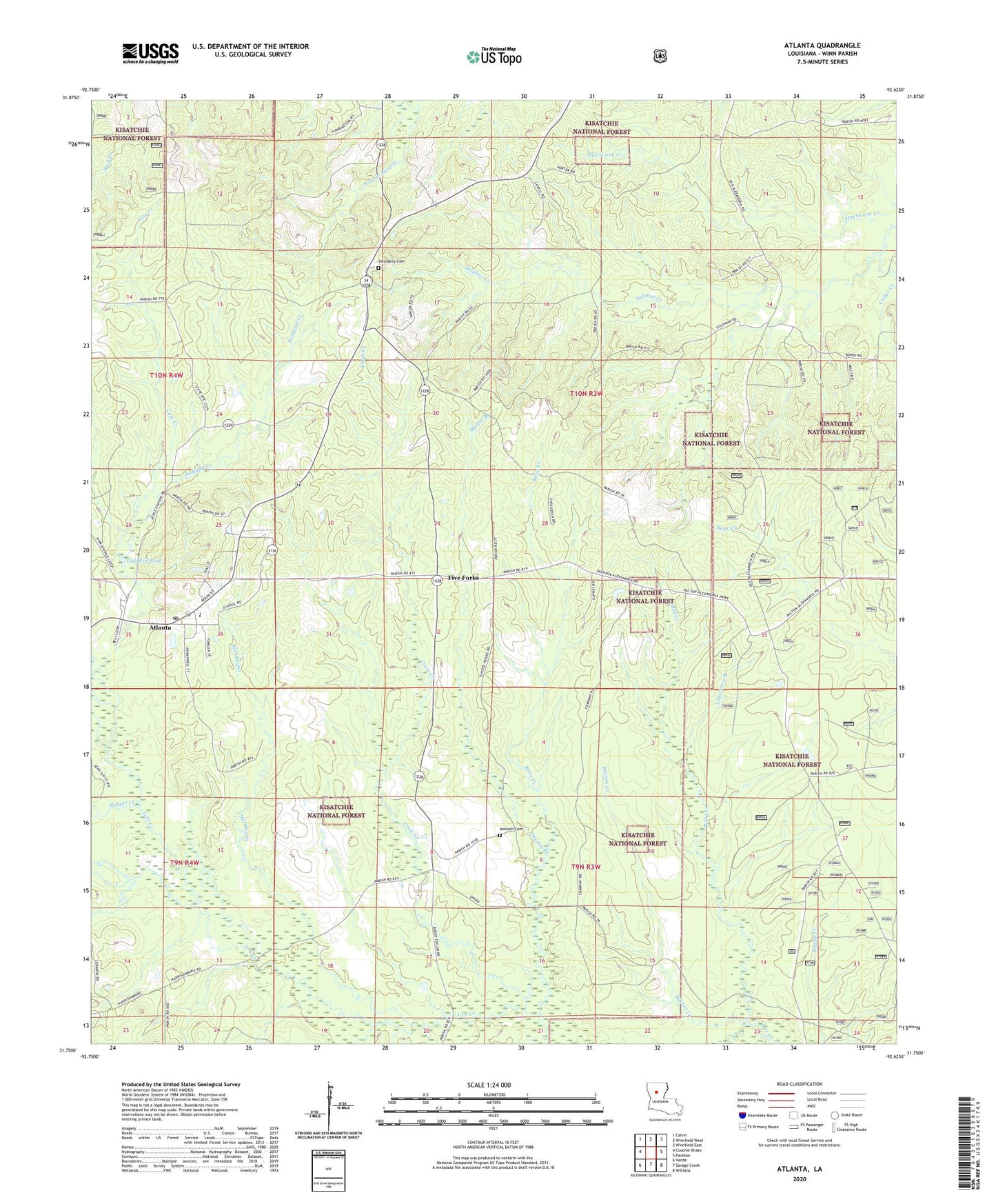
2024 topographic map quadrangle Atlanta in the state of Louisiana. Scale: 1:24000. Based on the newly updated USGS 7.5' US Topo map series, this map is in the following counties: Winn. The map contains contour data, water features, and other items you are used to seeing on USGS maps, but also has updated roads and other features. This is the next generation of topographic maps. Printed on high-quality waterproof paper with UV fade-resistant inks.
Quads adjacent to this one:
West: Coochie Brake
Northwest: Calvin
North: Winnfield West
Northeast: Winnfield East
East: Packton
Southeast: Williana
South: Savage Creek
Southwest: Verda
This map covers the same area as the classic USGS quad with code o31092g6.
Contains the following named places: Alonzo, Antioch Cemetery, Atlanta, Atlanta Gas Field, Atlanta High School, Atlanta Post Office, Beal Crossing, Bell Creek, Bulger Creek, Cedar Creek School, Cow Creek, Cruie Creek, Five Forks, Five Forks Gas Field, Hill Bayou, Iatt Creek Oil Field, Lawrence Branch, Macedonia Church, Marlin Branch, Ninth Ward School, Old Mill Pond, Prairie Home, Ratton Creek, Redland Creek, Rhoe Creek, Sardis, Sardis Church, Sardis Lookout Tower, Sulphur Creek, Sulphur Creek Gas Field, Swindelly Cemetery, Village of Atlanta, Ward Six, Whitford, Worsham Crossing