MyTopo
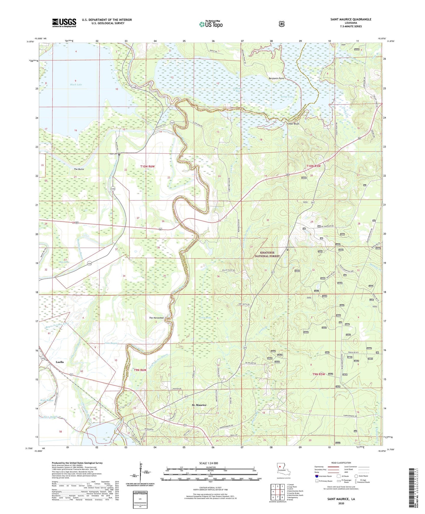
Saint Maurice Louisiana US Topo Map
Couldn't load pickup availability
Also explore the Saint Maurice Forest Service Topo of this same quad for updated USFS data
2024 topographic map quadrangle Saint Maurice in the state of Louisiana. Scale: 1:24000. Based on the newly updated USGS 7.5' US Topo map series, this map is in the following counties: Winn, Natchitoches. The map contains contour data, water features, and other items you are used to seeing on USGS maps, but also has updated roads and other features. This is the next generation of topographic maps. Printed on high-quality waterproof paper with UV fade-resistant inks.
Quads adjacent to this one:
West: Natchitoches North
Northwest: Campti
North: Coup Point
Northeast: Calvin
East: Coochie Brake
Southeast: Verda
South: Montgomery
Southwest: Natchitoches South
This map covers the same area as the classic USGS quad with code o31092g8.
Contains the following named places: Allen Chivery Dam, Allen Dam, Bayou Poisson Arme, Benjamin Point, Black Lake, Black Lake Bayou, Bourbeaux Bayou, Brule Bayou, Camp Allen, Cane Bayou, Cedar Bluff, Cheechee Bay, Chevreuille Bayou, Chivery Dam, Clear Lake, Couley Creek, Dogwood Trail, Evergreen Church, Harmony Church, Harrisons Ferry, Hassen Branch, Horseshoe Lake, Jacks Brake, Lemon Brake, Lemon Branch, Lick Branch, Lime Branch, Little Natches Bayou, Luella, Mauvais Coule, Morning Star Church, Mount Olive Church, Mount Pilgrim Church, New Enterprise Church, New Enterprise School, Old Morning Star Church, Pace Cemetery, Pace School, Redemption School, Saint Joseph Church, Saint Maurice, Saint Maurice Census Designated Place, Saint Maurice Plantation, Saint Maurice Post Office, Saline Bayou, Saline Cemetery, Saline Lake Dam, Strongs Ferry, The Butte, The Horseshoe, The Prairie, Trichell, Upshaw Creek, Ward Five