MyTopo
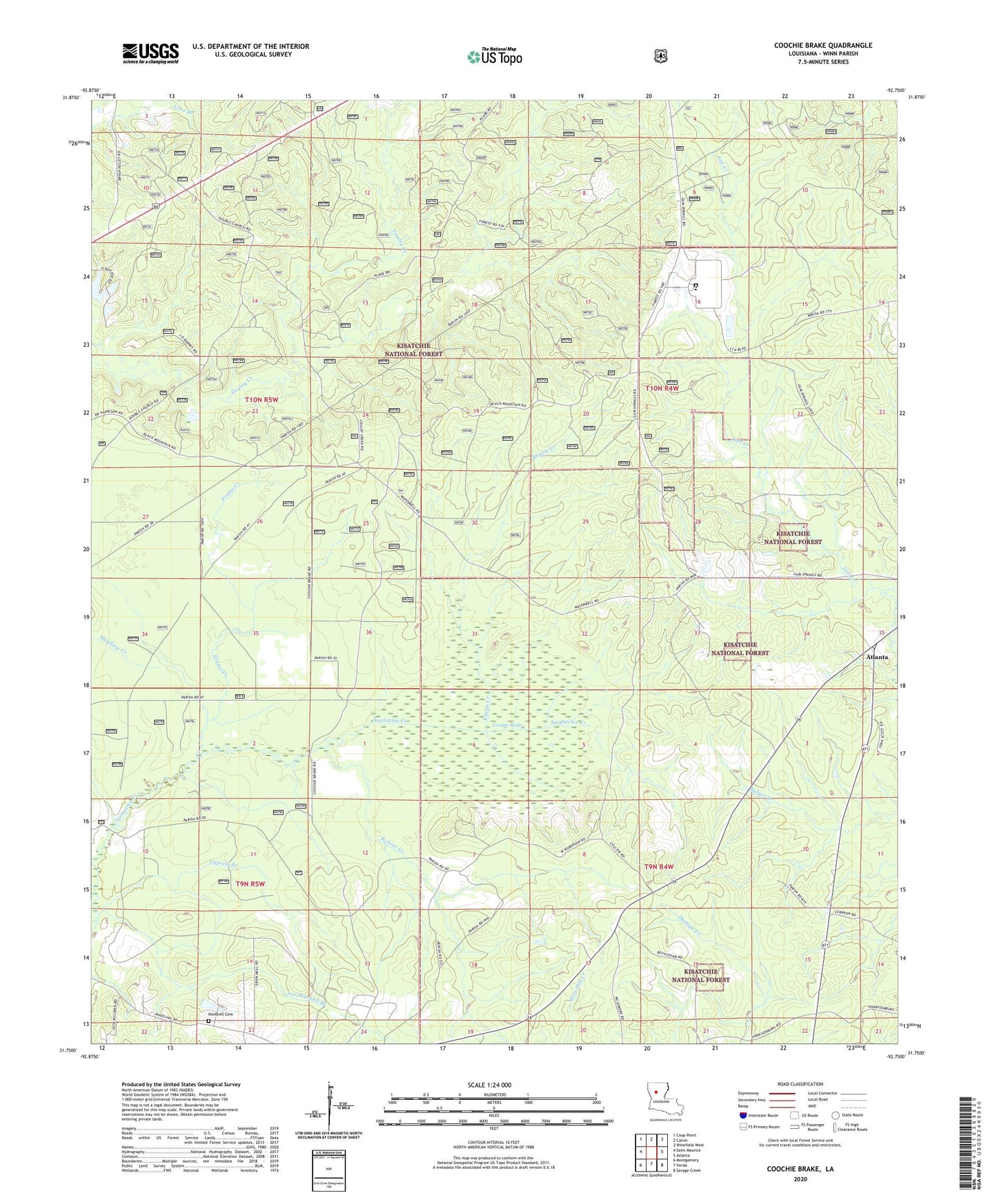
Coochie Brake Louisiana US Topo Map
Couldn't load pickup availability
Also explore the Coochie Brake Forest Service Topo of this same quad for updated USFS data
2024 topographic map quadrangle Coochie Brake in the state of Louisiana. Scale: 1:24000. Based on the newly updated USGS 7.5' US Topo map series, this map is in the following counties: Winn. The map contains contour data, water features, and other items you are used to seeing on USGS maps, but also has updated roads and other features. This is the next generation of topographic maps. Printed on high-quality waterproof paper with UV fade-resistant inks.
Quads adjacent to this one:
West: Saint Maurice
Northwest: Coup Point
North: Calvin
Northeast: Winnfield West
East: Atlanta
Southeast: Savage Creek
South: Verda
Southwest: Montgomery
This map covers the same area as the classic USGS quad with code o31092g7.
Contains the following named places: Bethlehem Church, Coochie Brake, Couley, Couley Church, Couley School, Cypress Branch, Double Church, Emden School, Frame Creek, Gravel Creek, Joe Mitchell Branch, Kensie Creek, Kimbrell Cemetery, Mayhaw Creek, Parish Governing Authority District 1, Parish Governing Authority District 8, Robins Creek, Winn Correctional Center, Winn Correctional Center School