MyTopo
Catahoula Bay Louisiana US Topo Map
Couldn't load pickup availability
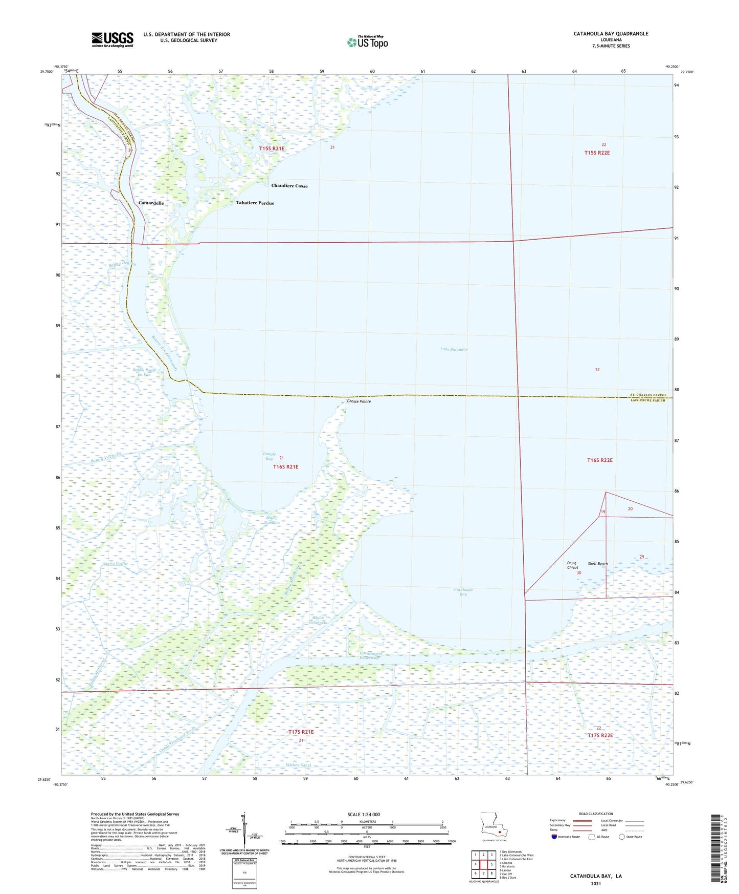
2024 topographic map quadrangle Catahoula Bay in the state of Louisiana. Scale: 1:24000. Based on the newly updated USGS 7.5' US Topo map series, this map is in the following counties: Lafourche, St. Charles. The map contains contour data, water features, and other items you are used to seeing on USGS maps, but also has updated roads and other features. This is the next generation of topographic maps. Printed on high-quality waterproof paper with UV fade-resistant inks.
Quads adjacent to this one:
West: Gheens
Northwest: Des Allemands
North: Lake Cataouatche West
Northeast: Lake Cataouatche East
East: Barataria
South: Cut Off
Southwest: Larose
This map covers the same area as the classic USGS quad with code o29090f3.
Contains the following named places: Baie des Chactas, Bayou Calfat, Bayou Catahoula, Bayou de Sauce, Bayou Degruy, Bayou des Allemands, Bayou Matherne, Bayou Plat, Bayou Poule De Eau, Bayou Tortillon, Bayou Vacherie, Bois Chactas Shell Bank, Camardelle, Catahoula Bay, Chaudiere Casse, Grosse Pointe, Harvey Canal Number Two, Larose Oil and Gas Field, Point Chicot, Point Chicot Gas Field, Shell Beach, Tabatiere Perdue, Temple Bay, The Temple Shell Bank, Wickey Canal