MyTopo
Gheens Louisiana US Topo Map
Couldn't load pickup availability
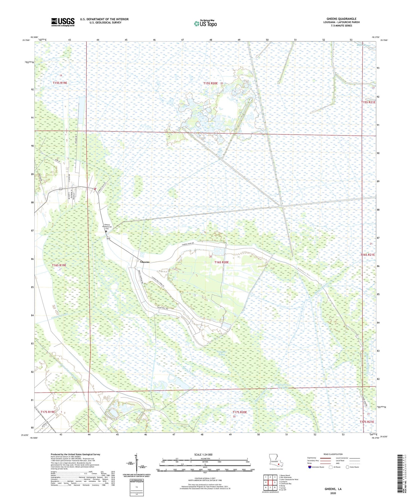
2024 topographic map quadrangle Gheens in the state of Louisiana. Scale: 1:24000. Based on the newly updated USGS 7.5' US Topo map series, this map is in the following counties: Lafourche. The map contains contour data, water features, and other items you are used to seeing on USGS maps, but also has updated roads and other features. This is the next generation of topographic maps. Printed on high-quality waterproof paper with UV fade-resistant inks.
Quads adjacent to this one:
West: Lockport
Northwest: Bayou Boeuf
North: Des Allemands
Northeast: Lake Cataouatche West
East: Catahoula Bay
Southeast: Cut Off
South: Larose
Southwest: Bourg
This map covers the same area as the classic USGS quad with code o29090f4.
Contains the following named places: Bayou Chateau De Cypres, Bayou Rixner, Company Canal, Gheens, Gheens Church, Gheens Post Office, Lafourche Parish Library Gheens Branch, Parish Governing Authority District 6, Petit Bois Bayou, Saint Anthony Church, Vacherie Gheens Volunteer Fire Department, Valentine Oil Field, Ward Eight, ZIP Code: 70355